As summer arrives and the days get longer, pilots may let their guard down when it comes to weather. Icing and large hail may certainly be less of a factor during the balmy dog days, but the June, 1999 American MD-80 runway excursion and the Delta L-1011 crash in August, 1985 are some of the incidents that underscore the hazards of flying during the warm season.
Thunderstorms can be awesomely beautiful phenomena when viewed from the ground. They also contain almost every known aviation hazard—turbulence, icing, hail, lightning, microbursts, reduced visibility, and strong winds. So, when viewed from the air, thunderstorms can be terrifying. Understanding the how and why of the weather and your weather avoidance tools can increase your margin of safety when slipping the surly bonds this summer.
The Basics
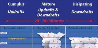
Updrafts with cumulonimbus cloud material, and downdrafts that are made up of relatively cool air and—usually—precipitation, are the elemental components of a thunderstorm. Nearly all parts of the storm and its behavior can be related to these two basic building blocks. For example, outflow and gust fronts are produced by the downdraft, while storm inflow feeds the updraft.
It’s important to remember that radar shows precipitation, not the smaller cloud droplets. Since downdrafts usually contain precipitation, most radar returns are associated with downdrafts. Why is this important? Because violent turbulence is concentrated in and around either the updraft or the downdraft. Radar is therefore not a predictor of turbulence.
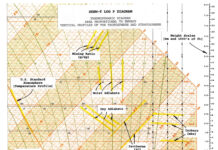
The intensity of the updrafts and the altitudes where they are strongest depend largely on lapse rate—the rate at which temperature decreases with altitude increase. In typical warm-season environments in the United States, the steepest lapse rates are found between FL050 and FL150. Updrafts gain most of their momentum by the time they reach these levels. Unless the upper troposphere is unusually warm, updrafts are drained of momentum when they penetrate the stratosphere.
The updraft will continue a short distance into the stratosphere in the form of an overshooting top, but this overshoot rarely extends more than several thousand feet into the stratosphere. Since the height of the stratosphere varies with season, cold-season thunderstorms will typically have tops at FL150 to FL250, while tropical and mid-latitude thunderstorms regularly reach FL500 to FL650. Hence, unless it’s winter and you’re flying a jet, “getting on top” of thunderstorms is usually not an option. The best course of action is to go around the thunderstorm.
The Hazards
When planning a penetration or just practicing avoidance, consider each thunderstorm hazard individually.
Turbulence In-flight breakups of aircraft due to turbulence are a Hollywood staple, but are extremely rare thanks to savvy use of airborne radar by airlines and avoidance by general aviation. Turbulence, caused by intense small-scale changes in wind flow, is concentrated in, around and between the updraft and downdraft cores. Here winds may ascend and descend at 100 kt in the heaviest storms. Radars detect precipitation, not air motion, and while the most intense turbulence may occur around the most intense echoes, strong updrafts and downdrafts may occur where no radar returns exist. Hence conventional wisdom tells us that no route within 30 miles of any strong radar return can be considered free of severe turbulence.
Icing Tremendous amounts of clear icing—when supercooled water impacts the airframe and freezes—exist in a thunderstorm extending about 10,000 feet above the freezing level. Due to the sheer volume of water in the storm, it is critical to avoid this layer. If you’re in the storm, either fly well above freezing levels or go below. Also if you must cross a storm, take the shortest route through it.
Hail There is no shortage of giant hail in the United States. The giant hailstones seen in news photographs were even larger up at flight levels before they encountered warmer air in falling to the ground. Fortunately hail screams out on radar, particularly if it’s large and wet, so avoiding areas of intense radar returns is the key to a safe passage. If you have no radar and severe weather is expected, there is no safe way through the cloud.
Lightning Lightning can occur anywhere in the storm and there is no way of avoiding a strike. The highest flash densities are centered around the freezing level, typically between about FL100 and FL200 during the warm season and lower during colder months.
Low Visibility According to the AOPA, VFR flight into instrument conditions remains the single biggest cause of weather fatalities. Staying in the clear and having alternates in mind will keep you out of the storm if you are unsure of your instrument currency and skills.
Strong Winds Storm complexes in the central US may produce widespread areas of 100 kt winds. The strongest horizontal winds are concentrated at the surface and within the anvil near the overshoot of the thunderstorm. Chances are your dealings with strong winds will be limited to tying down your aircraft and hoping for the best, but if you’re landing in thunderstorm conditions, be prepared. You may find yourself with sudden and extreme winds necessitating a last second go-around.
Microbursts Microbursts are intense, localized downdrafts—pools of cold, heavy air which rapidly sink to the surface. Microbursts frequently cause low level wind shear—a large change in wind over a short distance. Microbursts are possible whenever deep, dry layers exist in the low or mid levels of the atmosphere. Since microbursts exist before reaching the ground, spot readings of runway wind and a lack of wind shear alerts are no guarantee of safety when microbursts are present. Visual indicators such as heavy elevated precipitation, the development of a new storm, or the appearance of virga could signal surface microbursts.
Precipitation seen on radar over the airfield but not experienced on the ground may also indicate an imminent downburst or microburst. Microbursts, often thought of as landing and takeoff hazards, can sometimes engulf planes flying in the clear beneath a thunderstorm base. The best defense is to stay alert around weather indications of microburst activity.
Your Toolkit
Onboard weather radar remains a luxury enjoyed by airlines, the military, and the best equipped GA aircraft. The information revolution has brought amazing and affordable tools to even budget-minded general aviation pilots. Ground-based weather radar can now be accessed on smartphones, computer tablets, and airborne XM satellite weather displays that require only a small antenna in the window of an aircraft. It is important to emphasize that these displays are nothing like onboard weather radar units because they show what was seen from a remote ground station, not what is seen from your aircraft.
Portable weather data services tap into the federal WSR-88D NEXRAD network. Some services may also include TDWR (Terminal Doppler Weather Radar), a close cousin of NEXRAD. The weather data is not “live.” The radars have a vigorous volume scan process, where the antenna cycles through a dozen or more different tilts to create a full product. This takes a few minutes. Even if the network is relaying data instantly, the radar information itself may lag by 5 to 10 minutes. The bottom line is that these are not the best tools for finding fine-grained gaps in a line of storms and trying to thread the needle between them.
Next, what you see on your display isn’t necessarily what’s at your altitude. Two reflectivity products are used by weather services; base reflectivity—a view at a single radar antenna tilt, typically the lowest one, and composite reflectivity—a blend of all tilts, showing the highest reflectivity above a given point. Composite reflectivity is used on most public radar mosaics, in many radar apps, and in the XM display. If rain is being painted at your location, it may not actually exist at your flight level but at some point well below or above it.
Finally, the WSR-88D has a cone of silence over the radar site since the antenna is not tilted higher than 19 degrees. So, within 10 miles of a radar site only precipitation that exists within a few thousand feet AGL will be depicted. If a big hail core is at FL200 directly over a radar site and there’s only light rain below, it will not be shown on the radar display. Fortunately there is usually good overlap between multiple radar sites so that a nearby radar site will most likely cover the cone of silence of an adjacent radar site, but network spacing and occasional outages mean that this is not guaranteed.
What To Do
Obviously the best way to deal with thunderstorms is to avoid them as you flight plan. Your first line of defense is the convective SIGMETs, issued in the US by the Aviation Weather Center. These will show areas of storm activity, their altitude, and movement. You can crosscheck this with another look at the radar right before launch.
The next line of defense after you are airborne is again to avoid the storms, particularly not landing or taking off as a storm bears down on an airfield. Avoid severe turbulence by staying at least 10 miles away from all identified storms, and at least 20 miles from storms known to be severe, with these clearances preferably being upwind. If you’re using XM radar, remember there’s latency in the radar feed and extra distance between you and the storm is important to maintain your safety margin.
You may find yourself in the storm anyway, hopefully by accident rather than by design. Your job is using your knowledge of storms to steer away from the hazards. There is absolutely no way to do this without radar. Avoiding the strongest of the radar echoes continues to be sage advice. But your altitude deserves mention. You checked the freezing level when you were on the ground, right?
What else can be done? Now we’re crossing from the realm of meteorology to that of expert airmanship. This is the time for your skill as a pilot to shine. Chances are that by now you’ll know enough about storms to avoid the worst of them, and it will just be a matter of getting yourself and your passengers safely on the ground.
From the Aim…
As you’d expect, the Aeronautical Information Manual has some specific advice for flying in the vicinity of thunderstorms. Section 7-1-29-a discusses thunderstorm avoidance. It continues into section b to discuss what to do if penetration is unavoidable. While we’re not certain there are many situations where penetration is truly inevitable, consider this pre-penetration advice from the AIM.
Tighten your safety belt, put on your shoulder harness if you have one and secure all loose objects.
Plan and hold your course to take you through the storm in a minimum time.
To avoid the most critical icing, establish a penetration altitude below the freezing level or above the level of minus 15 degrees Celsius.
Verify that pitot heat is on and turn on carburetor heat or jet engine anti-ice. Icing can be rapid at any altitude and cause almost instantaneous power failure and/or loss of airspeed indication.
Establish power settings for turbulence penetration airspeed recommended in your aircraft manual.
Turn up cockpit lights to highest intensity to lessen temporary blindness from lightning.
If using automatic pilot, disengage altitude hold mode and speed hold mode. The automatic altitude and speed controls will increase maneuvers of the aircraft thus increasing structural stress.
If using airborne radar, tilt the antenna up and down occasionally. This will permit you to detect thunderstorm activity at altitudes other than the one being flown.
Section c finally provides this advice in case you’ve penetrated the cell.
Keep your eyes on your instruments. Looking outside the cockpit can increase danger of temporary blindness from lightning.
Don’t change power settings; maintain settings for the recommended turbulence penetration airspeed.
Don’t attempt to maintain constant altitude; let the aircraft “ride the waves.”
Don’t turn back once you are in the thunderstorm. A straight course through the storm most likely will get you out of the hazards most quickly. In addition, turning maneuvers increase stress on the aircraft.
Tim Vasquez, a career meteorologist, operates www.weathergraphics.com in Norman, Oklahoma. He hopes someday to have the opportunity to complete a dream and learn to fly.


