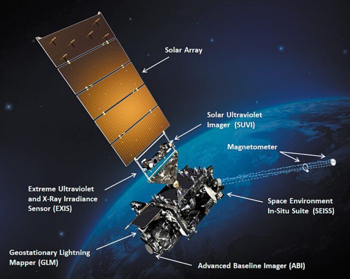
This close-up look at the modern GOES satellite shows the key equipment packages that are on board. (NASA/NOAA)
Satellite images and the data they provide are likely the biggest-single advance in weather forecasting. Let’s take a closer look at weather satellites.
To continue reading this article or issue you must be a paid subscriber. Sign in

Subscribe to IFR

Start a subscription to IFR for just $44.99. And access all of our online content - over 1,000 articles - free of charge.
Subscribe today and save 29%. It's like getting 2 months FREE!
Already Subscribed?
Click Here to Sign In | Forgot your password? | Activate Web Access

LEAVE A REPLY

Please enter your comment!
Please enter your name here