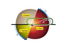
One of the things I enjoy about doing instrument instruction in the radar shadow of mountains is that students have to fly the occasional procedure turn. Radar vectors make this skill practically arcane for pilots over much of the U.S., so to actually see it needed in practice is eye-opening.
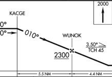
But it’s not just over the bumpy land where you might need or want a PT, and that’s what makes the ILS or LOC Rwy 18 at La Crosse, Wisc., interesting. An IFR reader sent a query our way as to how someone arriving from the south would get turned around on this approach without vectors. There is no PT charted.
Granted, the situation is unlikely. Radar coverage over the flatlands of Wisconsin is pretty sound, although outages certainly happen. There are also two DME arcs that GPS- or DME-equipped aircraft could use to swing about when approaching from the south. But not everyone has GPS or DME. What would those pilots have to do?
The answer is they better have some extra fuel on board, because the only IAF that doesn’t require GPS or DME is ELANE, 21 miles north of La Crosse. ELANE is the intersection of the La Crosse localizer and the Eau Claire VOR (EAU), which is another 39 miles north.
I can already see the emails coming in that even going to ELANE won’t work because the GPS-less aircraft would have no way of going direct to ELANE. Doesn’t that mean they need to fly all the way to EAU and then truck back to La Crosse—a round trip of an extra 100 miles?
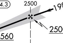
Not if ATC is willing to let you do a short hop off-route. While there’s no way to go direct to ELANE per se, that’s not essential. Long before the days of GPS for every pilot, those of us flying with two VORs could hack a near direct to an intersection with an approximate heading and the radials set up for the crossing point. If we needed to hit the intersection from one side—the way you’ve have to intersect the EAU R-163 just north of ELANE in this setup—we’d bias the heading to get to that radial first.
It turns out V129 runs directly between the Nodine VOR (ODI) and EAU. It would be an easy trick to navigate north on V129 far enough (using a crossing radial from another VOR to be sure) that a right turn would have you intersect the feeder route from EAU and take you inbound to ELANE.
The only catch is radar coverage. ATC won’t normally allow off-route navigation unless you’re in radar coverage (and if you were in radar coverage, you would just get vectors to final). But you don’t need to bring that particular reg up when you ask to go from midway up V129 over to ELANE and fly the approach. It’s also possible that radar coverage is available if you’re willing to start the approach a bit high. A short leg under VFR while in the clear above an undercast might be another way to pull this off. Of course, if fuel is really tight, declaring an emergency would work. But we like to avoid planning to declare an emergency as a way to shave some distance off an approach.
Part of planning is playing the what-if game with how you’ll navigate each leg of the flight. Don’t count on always having tricks like the PT waiting in the wings. But do keep your mind open to creative workarounds to get the job done without bending the rules too far.


