It’s rumored that bean-counters at TWA in the nineties determined that switching from Jeppesen to government charts would save $20 million a year. The idea was quickly squashed by the safety department. Twenty million a year wasn’t worth an accident due to misread charts.
Of chart providers, Jeppesen is arguably the best and inarguably the most popular, surpassing the U.S. Government’s AeroNav and Lufthansa’s LIDO products. But, underlying it all are humans, and we humans are a fallible lot. We make mistakes. This is exactly what Jeppesen did when it published approach charts with minimums of 1800 RVR being equal to 3/8 mile.
Jepp’s mistake is found on ILS approaches that support 1800-RVR minimums. The ILS 36R into Orlando (KMCO), Florida is but one example. There are others scattered around the country, usually at the biggest airports that can, indeed, support those lower RVR minimums.
Granted, government calculations between RVR and statue miles must be rooted in common-core mathematics. For example, the AIM RVR Value Conversion table equates 2400 RVR to 1/2 SM, but a calculator shows 1/2 SM being closer to 2600 feet. Jeppesen’s conversion of 1800 RVR to 3/8 SM is mathematically reasonable, but doesn’t follow guidelines in the TERPS, AIM, regulations, and government cartography specifications. The result is published visibility minimums below what is legal. This can set a pilot up for trouble.
Government Direction
A handful of documents govern the creation of approach charts from a data sheet. These include the AIM, Instrument Flying Handbook, Instrument Procedures Handbook, Interagency Air Cartography Committee Specification and TERPS. These documents paint a clear picture when it comes to visibility, 1/2 SM is the lowest available for CAT 1 approaches.
The TERPS dictate instrument approach design. Included in the TERPS is a table listing authorized RVR and visibilities. The chart lists 1800, 2000, 2200, and 2400 RVR all as equivalent to 1/2 SM. According to our resident TERPSter, Lee Smith, 3/8 SM used to be listed but was restricted to military use only. Therefore, 1/2 SM is the lowest that we civilians should be using.
The AIM provides similar guidance. It states that the “RVR to Visibility Conversion” table may be used for converting RVR to flight visibility. The AIM also says: For converting RVR values that fall between listed values, use the next higher RVR value; do not interpolate. For example, when converting 1800 RVR, use 2400 RVR with the resultant visibility of 1/2 mile. (AIM 5-4-20a.)
While the AIM is not regulatory, a pilot must still comply with 91.175, which states that a pilot cannot land if “the flight visibility is less than the visibility prescribed in the standard instrument approach procedure being used.” (91.175(d)(2)) RVR is not a flight visibility. When RVR minimums are published, the pilot must determine the flight visibility necessary to continue past the DA and to land.
The same regulation, 91.175, furnishes a “comparable value of RVR and ground visibility” table in paragraph (h). This table is used if “RVR is not reported for the runway of intended operation.” The problem is that RVR values of 1600 and 2400 are listed, with nothing in between. Also, this table does not contain the warning against interpolation that the AIM does. For pilots, this table specifically applies to ground visibility, which is a regulatory requirement for commercial operators versus flight visibility, which is required to descend below DA/MDA.
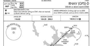
AeroNav charts either provide RVR or visibility for civilian use. These minimums are straight from the approach data sheet. Military minimums are adjacent to civilian mins in brackets and use visibility and decision height (AGL). The visibility value used for military minimums is derived from rules found in the U.S. Government Specifications for Flight Information Publication Instrument Approach Procedures and Airport Diagrams. The publication states: visibility will be the statute mile equivalent of the RVR visibility value identified with the DA(H) or MDA in accordance with the following table from 14 CFR Part 91.175(h). For RVR values that fall between the listed values, use the next higher RVR value. (3.4.8.7)
This document clarifies the prohibition against interpolation that is lacking in 91.175(h), making 1/2 SM the lowest visibility for practical purposes.
Getting in Trouble
This misprint can get us in trouble, inducing us to unwittingly break regulations. Automated weather stations can report visibility in eighths of a mile increments, making it possible for ATIS to report 3/8 SM. Landing with this visibility can get a pilot’s wings clipped.
We know from “How Far Can You See” (August, 2015) that flight visibility is required to continue below minimums and land. Only the pilot can judge this. But, if you think the requirement is only 3/8 instead of 1/2, you could incriminate yourself by telling an inspector you had 3/8-SM visibility.
Commercial pilots can get in trouble by just conducting the approach since their operating specifications have minimums not subject to Jeppesen’s slip-up. One-half mile is the lowest visibility for CAT 1 operations without RVR.
Crux of the Problem
Publishing equivalent visibility with RVR minimums is one of the advantages of Jepp charts. The pilot doesn’t have to dig through the AIM finding a conversion table if RVR is inop or not reported. Unfortunately, Jeppesen goofed here when it published the 3/8 SM visibility.
Jeppesen is aware of the problem and is correcting it. Many approaches, such as Orlando’s ILS Rwy 18R show the correct numbers. But, until all the charts are corrected, the take-away is that 1/2 SM is the lowest visibility usable for CAT I approaches, no matter what the approach chart says. Jeppesen is still the gold standard, but you’re the pilot in command.


