The vast majority of my flying has been east of the Mississippi. However, the end of last year found me traversing the other coast from Mexico to the Canadian border during a two-day evaluation of a VLJ pilot based outside San Francisco. Our second leg of the trip had us in Santa Monica, ready to depart for San Diego, when ATC pitched us a nasty curve.
My client’s call to Clearance Delivery was answered with the query, “Do you have the Santa Monica November routes onboard?” My client looked at me with a puzzled glance. After my own initial confusion (The what?), followed by a smart-aleck impulse (“Well if we do, what’s it worth to you if we let them go?”) I just shook my head to indicate I didn’t know what the controller was talking about either.
You could hear the exasperation in the controller’s voice as she realized we were going to have to do this the hard way, and proceeded to read us one of the most complex clearances I’ve received in quite some time. Once my client had read back the clearance, I asked the controller what that was about November routes. “They’re canned routes, sometimes you have them in the beginning of your book,” she enigmatically responded.
No Need to Write
I may not know a November route from an April route, but I do know what can be found “in the beginning of your book.” She meant the ubiquitous binder of Jeppesen text pages and terminal procedures. Besides pages and pages of staggering amounts of minutia (… this map symbol is small shrubbery growing next to a taxiway …) Jeppesen puts preferred and Tower En Route Control (TEC) routes in text pages filed under an “En Route” tab. A glance at the TEC routes originating from Santa Monica found a list, including the exact route the controller just read. It was labeled “SMON26,” as in “Santa Monica November Route 26.”
“Tower En Route Control” somewhat confusingly refers to flight entirely within the control of Approach facilities (TRACONs). The Center-controlled airspace (ARTCCs) is never involved. Where TEC routes are published, pilots are encouraged to file them so as “to avoid delays or other complications.” TEC routes generally coincide with preferred routes, which in the busy northeast are what you will fly, regardless of what you file for or would like. So looking up TEC routes can be an academic task for East Coast IFR pilots, and many may fly an entire lifetime without knowing what a TEC route is (or needing to, for that matter). In southern California, TEC routes are used so regularly that they’re named and numbered according to departure and arrival airports.
NACO chart users can find TEC routes at the end of the A/FD. You carry an A/FD with you on all flights, right? As our experience illustrated, having a copy of the little green book somewhere in the cockpit can save a lot of confusion; it’s nice to have the paper “canned routes” at hand.
Tougher with GPS
As the controller read the Byzantine clearance, my befuddled expression turned into a smile, then into an outright grin. I couldn’t have created a more devilish route to decipher and enter into the GPS had I tried, and as this was an evaluation flight, devilish was exactly what I was looking for. Here’s the route out of the A/FD:
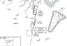
SMO LAX V23 SLI SLI148R V25 PACIF V208 LAX118R CARDI MZB320R MZB
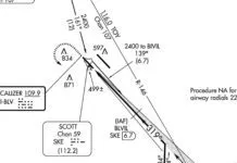
Got that? It’s not too tricky except for all those seven-character groupings like “SLI148R.” The clearance “SLI SLI148R V25” translates as “… Seal Beach, the Seal Beach 148-degree radial, intercept V25 …” There’s no named intersection where SLI R-148 meets V25, so we actually need to fly the radial outbound and intercept V25 when we cross it.
There are basically two ways to fly this section of the clearance. One way is easy to set up and trickier to fly, the other tricky to set up, but simple to fly. Short of a tidal wave about to crash over the airport, there aren’t many situations where a pilot can bend metal by spending a little more time on the ground. In the air, there’s no pause button, so that’s where I want things simple.
The first method is simply to put LAX R-123 (which defines V25) on a second Nav radio while tracking the SLI R-148 on the primary Nav. If the aircraft has an RMI, it can be set with LAX tuned in on NAV 2. When the tail of the needle is on 123, the aircraft is ready to turn on V25. You can do the equivalent trick with an EFIS such as the G1000 by putting a bearing needle for LAX on the HSI. As you hit 123 degrees to LAX, bear left onto V25.
A second method is more fail-safe because it makes it immediately apparent to the pilot that a turn on V25 is required, or better yet, will execute it automatically if the autopilot is engaged. If you have a GPS at your disposal, the answer is a user waypoint (UWPT). One of the ways to define a UWPT is by referencing radials from two known waypoints. Here, that’s the SLI R-148 and the LAX R-123. Insert this waypoint in the flight plan between SLI and PACIF. The aircraft will track 148 to the UWPT and then track 123 to PACIF. If we engage a capable autopilot, the plane will track the clearance perfectly whether the pilot notices reaching V25 or not.
How this UWPT is created varies slightly between Garmin 400/500s, legacy IFR GPS units and the G1000. It basically involves inserting into the flightplan a waypoint that has a name not currently used by other waypoints. The name doesn’t matter, but calling it something logical like SLI148 will help keep things clear in your mind when the airplane is navigating to it. When the GPS realizes you’re inputing a name that it doesn’t recognize, it will ask if you’d like to create a UWPT. Answering “Yes” will take you to the screen that allows defining the reference waypoints and radials. If you don’t feel confident you could create one, a little time with your GPS’s manual or a knowledgeable CFI will pay off.
Fortunately, it gets a bit simpler after that stretch, although it’s not apparent at first glance. The section of the clearance V208 LAX118R CARDI MZB320R MZB at first looks like it might take some more UWPT programming. However, some study of the en route chart reveals that “V208 HUBRD direct CARDI direct Mission Bay” is what the lengthier stretch quoted above is really saying. The CARDI intersection is defined by LAX R-118 and MZB R-320. The radials are there for pilots flying without GPS and unable to identify random points in space. No unusual pilot action is required once the chain of waypoints that define the clearance is entered into the flight plan.
Are You Active?
Once airborne, ATC had one final trick for us. Rather than direct SMO as the clearance states, we received extensive radar vectors for traffic until well south of LAX. We then received the clearance to “Turn left heading 070, intercept V23 east off HERMO.” Again, it’s trivial for the VOR-only navigators, but it can give GPS pilots fits if they’re only comfortable with direct to a fix.
The trick is make the leg between HERMO and SLI active. In Garmin systems, it’s done by a menu (G400/500 and G1000) or soft-key (G1000) option to “activate leg.” When this is done, the active waypoint becomes SLI, with a selected course/ desired track of 092, the course between HERMO and SLI. Now the pilot needs only fly the assigned heading until the HSI or CDI is centered, then turn to track. Note that this is different from selecting “direct-to” SLI, which would make the selected course whatever course is passing through the airplane right now. This isn’t what ATC wants us to track, so “direct-to” is not correct.
We Can Do That
As much as I enjoyed the clearance for the demands it placed on my client, I enjoyed it more for the affirmation that the little IFR tricks I try to drill into my students are actually needed at times. And, frankly, I enjoy learning something new myself: knowledge of TEC route locations, creating user waypoints, and activating legs all in one 45-minute flight!
It’s not every day ATC will throw so many curve balls at an IFR pilot, but it sure feels good to knock the ball out of the park when that day comes.
Neil Singer is a mentor pilot based in New England and an IFR Contributing Editor.


