In March, we examined the hazard of following a non-precision visual descent angle (VDA) below the MDA. This is easy to do because flying a non-precision approach with an advisory glidepath looks similar to an ILS, LPV or LNAV/VNAV with a real glidepath.
The key is that a non-precision advisory glidepath is not guaranteed clear of obstacles below MDA, as a real glidepath is. Assuming it’s safe is a widespread problem even affecting the airlines.
To understand safe use of advisory glidepaths, let’s look at the data and how it is processed by your GPS.
A Safety Compromise
VDAs are the angle between the runway threshold at the crossing height (TCH) and the minimum altitude at the final approach fix. Stepdown fixes are normally located so the VDA crosses the fix at or above the fix minimum altitude. AeroNav charts show these with the VDA and TCH anywhere in the profile view.
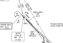
But sometimes a straight path from the FAF to the runway threshold crosses a stepdown fix below its minimum altitude. For these, the VDA is computed from the threshold to the stepdown fix minimum altitude rather than the FAF. AeroNav charts show this with the VDA and TCH squeezed between the stepdown fix and the runway in the profile view.
VDAs enable Continuous Descent Final Approaches (CDFA, also known as Constant-Angle Non-Precision Approach, CANPA) on non-precision approaches. These are safer than the “dive and drive” method and most airlines have adopted CDFA for non-precision approaches. However, on typical general aviation GPS units with WAAS, CDFA techniques are limited to flying GPS approaches to LNAV minimums with an advisory glidepath indication (LNAV+V).
But the comfort of flying a stabilized glidepath on the CDFA conflicts with the reality that obstacle clearance may not exist below MDA. This is enough of a concern that the FAA has just started to remove VDA information from approaches without obstacle clearance on the VDA below the MAP.
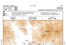
For these approaches, the VDA is replaced on the approach plate with a note stating “Descent Angle NA.” Removing the VDA, and thus the derived glidepath, solves the problem of pilots potentially descending into obstacles mindlessly following that derived glidepath. But, it also negates any benefits from the CDFA techniques prior to the MDA.
What’s in Your Database?
Properly flying a continuous descent on approach requires a glidepath indication, which is computed based on the VDA and TCH values stored in a GPS database. We spoke to Jeppesen to learn about how they process instrument procedures into their aeronautical databases.
Jeppesen receives its U.S. source data from the FAA and encodes the data in ARINC 424 format, the standard aeronautical data format used in aircraft. This data is then provided to vendors, such as Garmin. Although the format includes a lot of information, some of the details found on the actual approach chart are omitted—minimums, in particular—which is why pilots must still have a chart for the procedure being flown.
Jeppesen will include VDAs that are supplied in the source data, and compute them if not in the source data, unless the source data specifically deletes them by showing a zero angle as the FAA has begun to do. Jeppesen also ensures that supplied VDAs will meet all stepdown fixes. When the FAA’s VDA is computed based on a stepdown fix, Jeppesen data applies that VDA back to the altitude of the FAF. A pilot level at the published FAF minimum altitude will intercept this vertical angle after the FAF resulting in a delayed, but continuous, descent.
Inside Garmin Navigators
We also talked to Garmin about how they use the navigation data. Garmin receives navigation data from Jeppesen and converts it into a format for the actual devices in the cockpit. This is what you install.
Garmin requires specific conditions before they depict an advisory glidepath. Advisory glidepaths will only be displayed for GPS approaches (including overlay approaches) that have LNAV minimums and no charted LNAV/VNAV or LPV minimums. There is currently no support for advisory glidepaths to LP minimums. The unit must also be receiving WAAS and integrity at the same level as is required for LNAV/VNAV minimums. Finally, the procedure must have a non-zero VDA. That last requirement means that LNAV+V will be unavailable for procedures that have had VDAs removed by the FAA.
Procedures that meet these criteria will depict a derived glidepath. Because the VDA is relative to the runway threshold and independent of the MAP or approach minimums, the glidepath is shown all the way to the threshold. This is where pilots might get into trouble if they continue to follow the glidepath without regard to potential obstacles.
Why not discontinue display of a VDA below the MDA? Unfortunately, minimums are not included in the ARINC 424 source data. Additionally, the avionics could not know the applicable minimums for a given approach. The published minimums might be raised, for example by NOTAM or due to a remote altimeter source in use or even just circling vs. straight in.
Glidepath Interpretation
Pilots must realize that once past the MAP, they are responsible for their own obstacle clearance and should not assume they will be safe on the glidepath, as they are with an ILS. Any glidepath provided on a non-precision approach is for advisory use only. The AIM reflects this, avionics manuals and aircraft flight manual supplements reflect this, yet it remains a source of confusion.
This is a classic human factors problem with pilots being pulled in conflicting directions. Many pilots have been conditioned to follow the glidepath by years of flying ILSes and human nature is to remember best what we learned first. Since there are now glidepaths for advisory use only, it’s not surprising that a pilot under stress toward the end of an instrument approach might fall back onto their familiar ILS glidepath mindset.
At the same time, continuous descent final approaches on non-precision approaches offer very real safety benefits and are working their way into general aviation, as evidenced by LNAV+V capabilities in WAAS GPS navigators. How we can take advantage of the benefits of CDFA while avoiding obstacles if following an advisory glidepath below MDA is currently a hot topic within the FAA and industry; expect to hear more once the dust settles.
Approach Alchemy
We often think of DAs and MDAs similarly: the lowest you can go on precision and non-precision approaches, respectively. But there’s a subtle, important difference.
DAs are used on a real glidepath with protection all the way to the runway through a Glidepath Qualification Surface (GQS). Aptly named, the DA is the decision point. If you go missed, it’s OK to continue below the DA as you reconfigure to climb. Of course, the MDA is a hard altitude that you can’t penetrate unless landing.
But it would be simpler to apply CDFA techniques to treat an MDA as if it were a DA. This is known as a Derived DA (DDA). In limited circumstances with FAA approval, air carriers and some corporate flight departments may do just that through Opspec C073. Although this ability is off the table for Part 91 pilots, its requirements provide further insight into obstacle protection below the MDA.
CDFAs are considered for runways that have published ILS, LPV or LNAV/VNAV minimums, have the same final approach course, and have a VDA no lower than the glidepath angle. This assures obstacle clearance via the GQS of the other approach.
CDFAs can also be considered at Part 139 air-carrier airport runways with visual glideslope indicators (VGSI) where the VDA is no lower than the VGSI angle and is aligned within 10 degrees of the runway centerline. This relies on the obstacle clearance protection assured by the VGSI.
Use of a DDA allows operators to safely drift below minimums while initiating a missed approach. If an approach does not meet these requirements, CDFA techniques can still be applied, but the MDA is still a hard limit. For these approaches, the operator must initiate the missed approach at an altitude above the MDA (typically 50 feet) to prevent the aircraft from descending below the MDA.
On eligible approaches, Jeppesen continues the final course to the runway in the profile with the note “Only authorized operators may use VNAV DA(H) in lieu of MDA(H).” AeroNav doesn’t publish this information, so operators need other sources to determine eligibility for CDFA operations. —LS
Lee Smith is a flight instructor and a TERPSter at an airspace consulting firm in Northern Virginia. He’s grateful to the technical folks at Jeppesen and Garmin for their help with the gritty details in this article.


