Another summer is descending on the United States. We often think of summer as the time when we escape the grip of winter weather, strong fronts, and spring thunderstorms, but it’s easy to forget that summer brings hazards of its own. These can especially be a problem on cross-country flights that bring you into unfamiliar areas.

Icing
We don’t think of ice in July because of the weakening of large-scale weather systems and the rise of freezing levels to around 15,000 feet MSL. But bring tropical moisture into convective instability and we’re dealing with some very high liquid water content.
In fact, water content in a tropical air mass is so high that the designers of the NEXRAD radar system have had to revise the algorithms to more accurately estimate rainfall amounts. An icing study conducted in the 1980s by the University of Wyoming also found that icing accumulation in Florida during the summer was often slightly greater than that found in Great Plains winter storms.
If you’re flying low and slow, the good news is you’re not likely to encounter ice in the summer. But climb higher and it’s important to remain clear of possible ice in showers, storms, and any large precipitation areas.
Summertime IMC
In summer, wherever cold waters exist near warm inland conditions—places like California, Oregon, and occasionally around the Great Lakes and the New England coast—persistent IMC is likely.
A cold “marine layer” forms above the cold waters, where heat in the air mass contacts the water. This heat is absorbed and dissipated, chilling the air mass. Temperatures in this marine layer fall to the 50s and 60s. An inversion forms, and broken-to-overcast stratus and stratocumulus layers develop. Meanwhile, inland regions see strong solar heating and temperatures rise into the 80s and 90s.
Since cold air is dense and sinks, while warm air is light and rises, a thermal circulation develops that favors an onshore breeze flowing from the cold air mass to the warm air mass. This circulation transports the cold air and overcast layers inland. Coastal airports go from CLR to OVC005 in mere minutes. Usually this happens overnight, but can begin in the afternoon.
It’s ironic that places like California have more IFR hazards in summer than in winter. It’s best to plan your flights for midday, when last night’s ceilings have eroded and before stratus returns.
Sea Breezes
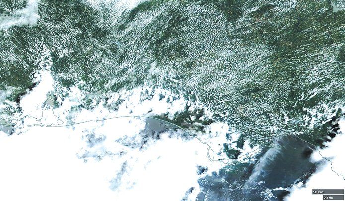
If your flight takes you places like Houston, Pensacola, or Orlando, be aware of the sea breeze. This has a huge effect on coastal weather near warm ocean waters. The effect is very similar to California’s sea breeze, but on a different scale.
The sea breeze develops in the morning, where it advances onto the beaches. The wind inland is either light and variable, or follows the prevailing flow. Wind is strong in the oceanic air mass, and almost directly onshore, bringing distinctly cooler temperatures. The marine layer is often only a few thousand feet deep, topped with an inversion. It’s essentially a miniature cold front.
By mid-afternoon, the sea breeze advances 10 to 100 miles inland, depending on the strength of the prevailing winds. If the dewpoint is high (20 degrees C or so) and there’s sunshine, thunderstorms will begin forming along the sea breeze. These storms normally don’t have much wind or severe weather, but visibility can be obscured in torrential rain.
The sea breeze continues advancing into the evening, and may ultimately reach up to 150 miles inland in places like Texas and Louisiana. Although it continues to generate showers and thunderstorms as it marches north, they rapidly weaken as the sun goes down. By midnight, the sea breeze activity is gone.
Be aware of your destination’s relation to the sea. Along the ocean at Panama City, Florida, you’ll deal with a lot of showers early in the day, around 1 p.m., but by 6 p.m. you will normally have no problems. On the other hand, further inland near Tallahassee and Valdosta, the weather is usually good around 1 p.m. but is much worse by 6 p.m.
Air Mass Thunderstorms
Air mass thunderstorms are a catch-all phrase for the classic summertime “popcorn storm” that develops when there’s a warm, humid air mass and the charts show no fronts or other focusing mechanisms. They’re very common in the eastern U.S. particularly in mountainous areas and in the Rockies, and can form anytime during the warm season when there’s enough moisture and instability. Severe weather is rare but microbursts can occur if there’s enough dry air aloft.
Air mass thunderstorms are forecast well by the TAFs, and coverage is discernable from the official forecasts. Avoid them by flying in the morning, and using a Strikefinder or airborne weather radar if you get caught.
Without those tools it’s important to get on the ground or find a route out of the activity if buildups start growing around you, because air mass storms often grow as clusters and the open spaces will quickly close in. If you don’t think air mass storms are a problem, check out our August 2018 issue that details two seemingly benign air mass storms: one that downed a Piper PA-23, and another that downed a Boeing 727.
Southwest Monsoon
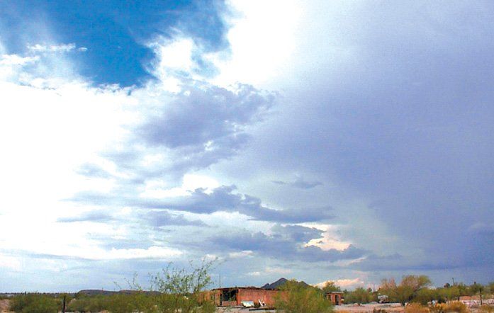
A major change that occurs in the Southwest states is the summer monsoon, triggered by intense heating in the desert that generates a broad low-pressure area that can extend to the Great Basin. This gradually attracts moist air masses from the Gulf of California, Mexico, and the Gulf of Mexico. This moisture surge normally reaches New Mexico in June, Arizona in July, and much of the Rocky Mountains and Great Basin in August.
Early in summer, conditions are solid VMC, with very hot afternoons. When the monsoon arrives, the mornings start out VMC, with cumulus buildups appearing over the mountains by lunch. These develop into thunderstorms, and by late afternoon they move over the valleys. They normally dissipate by late evening, leaving mid-level debris clouds, though if there is upper level support, some of the storms can continue overnight. The entire monsoon pattern subsides through September as solar heating diminishes.
To avoid monsoons, watch the calendar and the weather patterns. If it’s August and you’re flying from Albuquerque to Phoenix, fly during the morning hours as much as possible. Try to get to a stopping point by early afternoon, and always tie down your airplane securely, as 50-knot wind gusts in monsoon storms are common.
You can also keep tabs on the monsoon by watching the winds aloft. If there’s a big bubble high across the Southwest states (common in June), the onset of monsoons will be stalled. Upper highs shifting east to the Great Plains while places like Dallas and Tulsa are reporting heat waves, often coincide with deep southerly flow in Arizona, which helps the monsoon invade the deserts.
Northern Plains Storms
Summertime means organized thunderstorms across much of the northern Great Plains. This is from a combination of Canadian fronts slipping into the U.S., intense heating on the high plains, and tropical moisture reaching further inland. Early in the summer, most of the activity is in Nebraska, western Kansas, and eastern Colorado, but by July it expands into the Dakotas, Minnesota, Wisconsin, and Iowa.
The jet stream position is a good indicator of what’s going on is. If it’s north in Canada, Northern Plains storms are likely to be weak. But if the jet stream dips into the Lower 48, storms are likely. The isolated storms can be prolific hail producers. Hailstone records in this century were all set in the Northern Plains: Nebraska in June, South Dakota in July.
These storms often organize overnight and produce mesoscale convective complexes (MCCs). They’re very important to corn and barley production with their long, soaking rains. The MCCs usually reach the Great Lakes or Illinois by morning and fizzle out into cirrus debris by noon.
Exceptionally strong storms can organize into damaging squall lines called “derechos,” which can reach much further east, often into Ohio, New York, and Pennsylvania. A west-east warm front lying across the Midwest, along with a west-east jet stream in the same area is a good setup for a derecho. The risk is also indicated on charts from the Storm Prediction Center(www.spc.noaa.gov). Convective outlook charts showing a moderate or high risk across the Midwest in the summertime indicate a derecho threat. You’ll want to pick an alternate route, as derechos are large systems that are hazardous to penetrate without airborne radar.

Tropical Storms
Sea surface temperatures are coolest in March, then rapidly warm through the summer. High sea surface temperatures combined with weak wind shear help produce tropical storms.
These start as thunderstorm complexes producing a lot of latent heat as a byproduct of all the clouds and precipitation. The latent heat causes pressures to fall. This leads to wind convergence and more thunderstorms, creating a feedback loop. Initially these storms are called tropical depressions, but when sustained winds rise to 34 knots they become tropical storms. The 63-knot winds bring them up to hurricane status.
The risks begin to surface in June. Most tropical cyclones are weak and remain far out in the Atlantic, but a few weak storms make their way into the Gulf Coast and Florida. As July wears on, the storms strengthen, and the entire Gulf Coast, Caribbean, and southeast states fall under a heightened risk of tropical cyclone activity. The highest risks come in August and September. Many hurricane disasters like Katrina, Ivan, Ike, and Andrew occurred during these months. The risk declines in October and November, and risks shift from the Gulf to the Atlantic Coast states.
Tropical cyclones are rarely seen in the NTSB archives because they’re easily avoided and pilots usually have a few days to get their planes inland. However a special mention needs to be made of the outer spiral bands. Here the winds are often no stronger than 10 to 20 knots, making it easy to dismiss the storms as mere showers, but the abundance of dry air aloft and strong shear in the lower levels often helps supercharge these storms. It’s a good idea to consider all spiral band storms as having the potential to bring strong gusts, microbursts, and a few tornadoes.

Density Altitude
Finally there’s density altitude, a huge factor in mountain and summertime flying.
During the summer, mountainous regions become unusually hot due to the high solar angles, the warmth of the prevailing air mass, and the dry conditions. Take the example of Aspen, Colorado. The airport lies at 7800 feet and often reaches 85 degrees F in the summer while 31 degrees is “standard.”
Under these conditions your airplane will behave like it’s at 11,200 feet MSL. This can significantly increase your takeoff run and make it difficult, if not impossible to climb out safely. Heavy weight and a short runway can quickly put the aircraft in danger. YouTube has several notable examples of crashes tied to high density altitude, perhaps the most vivid one being the 2012 crash of a Stinson 108 in Idaho.
High density altitude is not only caused by high altitude and hot temperatures, but is compounded further by an unusually low barometer and high dewpoint readings. You usually can’t do much about any of these, but you can do your flying in the morning, when temperatures are cooler. Departing when it’s 70 instead of 90 will effectively give you the same performance as an airport that’s 2000 feet lower.
Density altitude is often thought of as a mountain-flying problem, but it can rear its head wherever the weather is unusually hot. For example, when the mercury hits 105 in Dallas, your airplane will behave like it’s at 3600 feet MSL. If you’re in the Rockies or in New England, density altitude is a serious potential hazard, because the Climate Prediction Center is calling for an unusually hot summer in those regions.
Tim Vasquez spent part of his Air Force career keeping B-1B crews safe while flying in the hot summer conditions of west Texas and eastern New Mexico. You can learn about his books and software atweathergraphics.com.


