How We Die, Part 1
(This is the first of a four-part series of articles in which contributing editor Fred Simonds will fully explore common, oft-fatal mistakes that we...
Skew-T Simplified
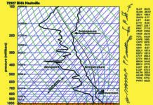
Skew-Ts aren’t the sort of thing you learn about in ground school, but I’m quite outspoken about how important they are to understanding the...
Choose a Shortcut
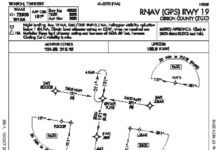
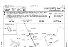
Things are getting busy approaching Trenton, Tennessee, Gibson County (KTGC), even though its not that bad. But the skies are grey enough to make you squint as you enter the overcast. Youve also entered, as youll soon find out, the murky realm of the regs. A cold crust of rime clings to the aluminum and probably the antennas, so youre anxious to get into that toasty hangar at TGC. Worse, the suns going down and the gyros acting up. So any shortcuts (safe and legal, of course) would be great right about now.
Winter in the West
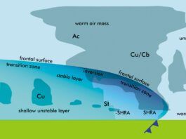
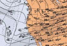
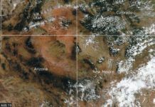
During low index patterns, these frontal systems can be quite deep, even extending into southern California, producing cold-core lows and showery weather. This also tends to allow moisture to circumvent the Sierra Nevadas through the Mojave Desert into the Great Basin, causing snowstorms eastward into Utah. These deep storm systems are particularly favored during El Nio years (the pattern this winter is neither El Nio nor La Nia), but they can occur in any season and theyll definitely have impacts on your flying plans.
Filed vs. Cleared vs. Flown
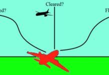
Every instrument pilot should understand the process of filing, getting a clearance, and then flying an IFR flight plan. But why does it occasionally seem that ATC makes things complicated? Say you've filed a straightforward Point A to B then C. But then you're cleared from Point A to B then to X, Y, Z, and only finally to Point C. Why are these extra fixes in the flight plan? Where did they come from? Why this today instead of an intermediate RNAV fix that you usually get?
Any Ol Alternate
Pop quiz: When must you file an alternate? Thats an easy one, we all know the rule about needing 2000-3 one hour before and after the ETA. Next question: When do you file an alternate? Probably the most common answer is, I always file an alternate. Fair enough, its never a bad idea. Now, regulations aside, why do you file an alternate? Naturally the response is: In the event the weathers gone down too low at the destination and we need somewhere else to go. Right up there is an unexpected loss of equipment or a navaid required for an approach. And while the regs are also designed to provide a backup for lost communications, this often serves as a distant third, cause these days were just not all that worried about that.
Weather Models
Since this is the first issue of IFR Magazine in the 2020s, its fitting that we stop and look at how far weve come with computer forecast models. Theyve made a huge impact on aviation forecasting. If you just take the single-engine up for an hour on the weekend, you probably dont have much need for the weather models, but if you do any sort of regular cross-country flying, chances are youve run across at least some of them.
WEATHER ACCIDENTS #10
This is our tenth weather-accident article in a series we started in 2015. Our intent is to examine some of the ways that seasoned pilots manage to get into deadly predicaments. Safety procedures are well-covered in training materials, your aircraft manual, and FAA publications, so we prefer to teach the aviation meteorology of these situations. Our goal is to give you a rich background to help you to make good decisions when things go wrong.
Satellite Imagery
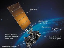
Since the mid-1970s, satellite imagery has made its way into everything from television weathercasts to flight weather briefings. We see them constantly. When a hurricane is approaching the coast, viewers are presented with satellite images. When the local news shows the forecast, a satellite image is almost always used. This technology has grown progressively more complex and powerful over the years, and more than ever it can be a valuable part of flight planning. Lets examine some of the basics of the technology and look at todays capabilities.
Clearing Flags
Its certainly legal to fly through the AIRMET. These are advisories covering large areas. But it behooves you to determine that your flight plan wont enter known or forecast light or moderate icing conditions as prohibited in 91.527. Here goes. Theres a stationary front just west of the route, bringing in cloud layers and scattered showers. Freezing levels will hit between 7000 and 12,000 feet. So, at 8000 feet, you do risk picking up ice. One lone pilot report from a single-engine turbine over Iowa shows negative ice in climb from 3000 to the tops at 11,000. This isnt all that useful since youre flying lower and slower, but you are willing to climb as high as 12,000 feet to be on top. Your Plan B, while not at all mission-friendly, is to turn back to warmer air and land in Iowa, or even return to Bowling Green if thats best.
Self-Brief the Weather
But a standard brief alone does not satisfy 91.103. If IFR or flying outside the airport vicinity, we are expected to also know fuel requirements, alternates if the planned flight cannot be completed, and any traffic delays advised by ATC. We must know the runway lengths, including takeoff and landing distance data if an Airplane Flight Manual exists. Else, we are told to make do using other reliable information appropriate to the aircraft including aircraft performance.
How the Wind Blows
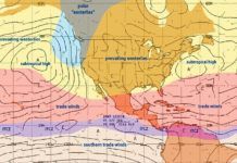
The root cause of wind is the unequal heating of the earth. We usually take it for granted that tropical areas are hot while polar areas are cold. But whether youre in Greenland or Venezuela, the sunlight is the same. Its the angle at which the suns rays hit the ground that makes the difference. Near the equator, the summer sun is at very high angles. But, in Greenland the summer sun never gets higher than about 30-40 degrees above the horizon, spreading the energy over a larger area, reducing heating of the ground and air.


