Canadas ADS-B
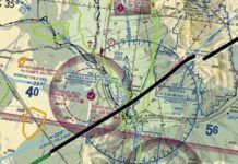
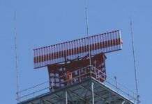
Just to make sure you understand whats up, lets review. In the U.S., weve got excellent radar coverage, so all those radar sites have been modified to understand your aircrafts ADS-B out transmissions. In those areas where radar sites dont quite have adequate coverage, the FAA has added ground stations specifically to receive your ADS-B Out. The bottom line is that the FAA has sufficient ground-based coverage to know where you are almost all the time, using your ADS-B Out.
Why GPS Doesn’t Work
Dark clouds are looming on the horizon of our otherwise exciting GPS future. With increasing frequency, the military is jamming or spoofing GPS over huge swaths of airspace. A typical GPS NOTAM for Albuquerque center covers a radius of 237 NM at 10,000 feet, 207 NM at 400 feet and 165 NM at 50 feet daily for most of a week. Pilots in the Southwest have become accustomed to these NOTAMs, but theyre becoming more frequent and expanding to other areas of the country.
AIM Is Non-Regulatory
The Parts, Subparts and Sections of Title 14 of the Code of Federal Regulations, what we commonly call the Federal Aviation Regulations or FARs, are the only truly regulatory documents we have. These are the formal regulations adopted by the FAA. They are authorized by an Act of Congress. Sometimes the authorization is general. When created by the Federal Aviation Act of 1958, the FAA was given broad authority to issue regulations to carry out its functions. Sometimes it is specific like the Congressional mandates to increase ATP requirements following the 2009 Colgan crash or to create BasicMed.
The Payoff
However, the FAAs ADS-B installation date of January 1st, 2020 was nearly a decade away, and he faced a hostile audience. Numerous pilots seated around us hit him on point after point. The price of the transponder units. The installation and certification headache. The lack of ADS-B coverage (at the time). The overall cost-vs.-benefit scenario. They clung to the if it aint broke, dont fix it theme. The company rep did his best, but it was a frustrating battle.
Sneak in the Side Door
Before you get a contact approach, some more boxes need to be checked, starting with weather minimums on par with Special VFR and Class G airspace. AIM 5-4-25 kicks off with them: Pilots operating in accordance with an IFR flight plan, provided they are clear of clouds and have at least one mile flight visibility and can reasonably expect to continue to the destination airport in those conditions, may request ATC authorization for a contact approach.
Finding Non-Precision
As we move forward in time with the proliferation of LPV approaches, the phaseout of non-precision approaches using ground-based navaids such as VOR, NDB, and LOC-only will result in fewer and fewer non-precision approaches. Furthermore, some WAAS navigators often provide an advisory glideslope to non-precision RNAV approaches: LNAV+V and LP+V. The +V refers to the advisory glideslope. An LP (localizer performance) approach is a non-precision RNAV approach that requires WAAS. Bottom line: there is almost always an electronic glideslope lurking in the shadows.
High Too Tech
Step two: Set the clock that held no resemblance to the actual time of day. I fiddled with it for a few minutes and gave up after finding myself seemingly 50 layers deep in menus. I assigned the task to my wife, also an engineer and a pilot. She even got out the manual-a separate one for the man-machine interface but after a frustratingly long time, she was also defeated.
Accidents: AA 1420
One of the last weather-caused airline crashes in the United States was American Airlines Flight 1420 in Little Rock on June 1, 1999. As we mark its 20th anniversary, well tie together some of the radar and thunderstorm skills weve learned in previous articles. Youll also see brand-new radar scans of the storm from modern high-resolution display software-which is far more detailed than that in the NTSB report-and well contemplate what you might see if you encounter a similar storm on modern radar today.
Better than TAF?
A dmittedly, Im an unabashed geek, getting my jollies running statistical tests querying the actual NTSB relational database and publishing my aviation safety research in journals using scientific mumbo-jumbo-the majority (if not all) of which would put any insomniac to sleep in a heartbeat. That said Im also an active general aviation pilot. Here, Ill don both hats as I cover a hot-off-the-press scientific paper published in the Atmosphere journal, translating from highfalutin language into laymans English for the benefit of the general aviation pilot population.
How Far Can You Go?
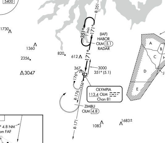
If issued an en-route clearance limit, you will be given holding instructions. If the pattern is charted, and they rarely are, you might be issued, Hold east as published. Most moving map displays such as the G1000 and GTN series do not show published holds, necessitating a chart, but ATC will issue full holding instructions if requested. The FAA frowns on unpublished holds, saying that only those holding patterns depicted on U.S. government or commercially produced charts which meet FAA requirements should be used. This is another reason why rolling your own at JIDUK, is a shaky idea.
Comparing LPV and ILS
A rriving at your destination on a dreary day, ATC queries you with say approach requested. The landing runway has an ILS and an RNAV (GPS) approach with identical LPV minimums published. Which do you choose? You would be forgiven for thinking, as we initially did, that this is a bit of an inconsequential question. WAAS has enabled satellite guided approaches to have precision comparable to Category I ILS approaches, so what difference does it make? Although true, this doesnt mean that ILS and LPV are identical in all regards.
Hear Back, Read Back
Lets start out with a few simple examples and work our way up. One of the most-used examples is, Tower, Cessna 12345, ready for departure, Runway 14L. Cessna 12345, Tower, hold short Runway 14L. The caution below appears on many charts, but have you really assimilated what its telling you? Its simple. Essentially, if the controller says the word runway you should read back the explicit instruction: Cessna 12345, holding short Runway 14L. This is the proper way to respond.

