A DME/DME RNAV Future?
The FAA’s Minimum Operating Network (MON) focuses on serving general aviation. Why? How will the airlines and heavy corporate birds survive a significant GPS...
New IFR Website
We’re pleased to present to you IFR’s brand-new website. On the site, you’ll find more than a thousand articles, lessons and reenactments to keep...
ILS on the Block
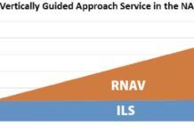
In 2015, the FAA began looking to rationalize ILS approaches. In this context, rationalize means cut. The following year, the FAA developed a cost/benefit quantitative model and conducted an analysis at about 2900 airports with few or no RNAV SIDs or STARs. The finished product was a plan to decommission Cat I ILS approaches at some of these airports between 2020-2030. Before a decision was reached, the project was shelved in 2017.
Choose a Shortcut
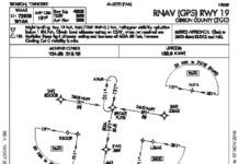
Things are getting busy approaching Trenton, Tennessee, Gibson County (KTGC), even though its not that bad. But the skies are grey enough to make you squint as you enter the overcast. Youve also entered, as youll soon find out, the murky realm of the regs. A cold crust of rime clings to the aluminum and probably the antennas, so youre anxious to get into that toasty hangar at TGC. Worse, the suns going down and the gyros acting up. So any shortcuts (safe and legal, of course) would be great right about now.
Check Your Data
At the airport, Ill pull the airplane out of the hangar, preflight, and hop in. Once inside I get the ATIS and clearance before starting the engines. That morning Tower was still closed-Im a morning person-so in good VMC, I planned to launch VFR and pick up my clearance in the air from Center. With the engines running, I uploaded the flight plan from Pilot. Thats where the first sign of trouble popped up; my Garmin GTN 650 didnt like the flight plan from my Garmin Pilot EFB. It was fine last time. What the…
Radio Confidence
Remember when you first picked up the mic in an airplane, either to ATC or at a non-towered field? Most of us were probably as tentative as a boy trying to get his first date . Even if youre good at public speaking, few of us gain the comfort without first practicing with prepared remarks. But, on the radio our scripts are too vague and variable; we have to learn along the way. Meanwhile were so worried about sounding bad or saying the wrong thing, we often sound bad and say the wrong thing. Fortunately, practice makes perfect-or at least better.
Got em On the Fish Finder
The FAA does a fine job of providing a framework for our safe flying. But, even within that, there are a few arcane things that might not make sense or might be done better. My favorite example is 91.126 that essentially says if the Class G airport has standard left traffic, When approaching to land … each pilot of an airplane must make all turns … to the left. Its difficult to argue that entering a traffic pattern isnt approaching to land, but that first turn is to the right, against the rules. (Yes, the FAA has talked around this, but it says what it says and thats not what we do.)
Backing Up GPS
The MON will remain until an advanced system emerges that can seamlessly recover from a GPS failure. Until 2014 the FAA advanced a system that provides alternate positioning, navigation, and timing (APNT) as GPS provides PNT. In 2015 APNT research was pushed into NextGens far term, 2026-2030. Once the MON is complete, the FAA plans to re-evaluate existing VORs, but at that point, APNT research will just be getting off the ground. The bottom line: some VOR navigation will be with us for years to come. Youd be well advised to keep your VOR navigation skills sharp.
Briefing: December 2019
FlightAware and FlightBridge are teaming up to organize private aircraft travel from doorstep to doorstep with predictability and accuracy. At the recent NBAA-BACE convention in Las Vegas, the two companies announced an integration of their two systems that will let business and private travelers plan their journeys down to the last detail while harnessing machine learning to ensure they go as smoothly as possible.
GETTING A PROCEDURE PUBLISHED
A new or modified procedure is a coordinated effort among many groups, such as airports, air traffic control, local communities, and local aircraft operators, each of whom may have input into the final procedure. Once a procedure is developed and everyone is as happy as theyre going to get with it, the procedure is sent through a quality assurance review process. This process essentially rebuilds the procedure to verify criteria compliance, use of correct data, and proper documentation. Once past quality assurance, the next step in procedure approval is performing a flight inspection to look for anything unsafe or unexpected on the procedure that wouldnt have been known during the design process.
ATC Safety Net
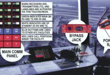
The most obvious and essential ATC tool is a working radio. Imagine an airport is fogged in, with hard IMC and essentially zero visibility. The tower controller cant see the airplanes. However, using a single radio with his knowledge of the airport layout, and accurate position reports from pilots moving around in the soup, he can still work the traffic. Radar controllers can also rely on pilot position reports to separate traffic in non-radar operations. Again, all they need is a radio and knowledge of their surroundings to build a mental traffic picture.
TERPS 101
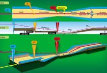
Since we trust our lives to procedures designed to TERPS standards whenever were in the soup, lets pull back the curtain just a little bit to see whats going on behind the scenes of our approach charts. Note that collectively the TERPS standards easily run over 1000 pages and often involve quite a bit of math, so this is intended to be an overview and is by no means exhaustive. We will be looking at basic concepts and how they apply to approach procedures in this article; in a future article well discuss standards for other phases of flight.

