Readback: July 2020
Dangerous Identifiers
I enjoyed Elaine Kauh’s article, “Making Do, Part 2” back in the August 2019 issue. It accurately reflects the decisions— and sometimes the...
Readback: June 2020
Remembers Eagle Fondly
I must compliment Brian Willett on his excellent Tricks of the Trade article in the March 2020, “Ski Country Flying.” The article...
Readback: May 2020
Deskewed Me ... Or Not
In the first of your articles simplifyingSkew-T diagrams (March 2020), you mention that a reader suggested you simplify them or...
Readback: April 2020
Who Cancels Flight Following?
When receiving VFR flight following who has the authority to cancel? I haven’t found any clear guidance for situations where ATC,...
Readback: March 2020
Sim Challenge Workout
I love the magazine! Amazing work all around.
I just completed Jeff Van West’s November Sim Challenge (around Monterey, CA) on my own...
Readback: February 2020
I noted an interesting change to the Instrument Rating ACS released back in June last year. It used to be that per the ACS, a circling approach required a heading change of at least 90 degrees from the final approach course to the landing runway. That requirement is now gone, replaced with the requirement to Visually maneuver to a base or downwind leg appropriate for the landing runway and environmental conditions. Also, new language was added saying the pilot must not bank over 30 degrees.
Readback: January 2020
Your shop gave you bad advice. Garmin says that the frequencies are sufficiently different, even counting various harmonics, that interference wouldnt be an inherent problem. They do, though, recommend a minimum of two feet between a GPS antenna and any strong transmitter. There are few, if any, airframes where it would be impossible to get at least that. If your tech, however, has seen that problem, its likely due to other factors, like poor antenna grounding, poor connections, bad wiring, etc., but not antenna proximity unless they were right next to each other.
Readback: December 2019
In the August 2019 Readback, your reply to the writer who was referring to the More ILS vs. LPV article (February 2019) errs when you say that GPS is a single receiver system for various satellites and WAAS ground station(s). WAAS data is transmitted to users from geostationary communications satellites. Currently three geo comsats are broadcasting WAAS signals covering North America.Jim TorleyColorado Springs, CO
Readback: November 2019
With that article, we thought wed put this whole discussion and its confusion behind us. However, as soon as the magazine hit your mailboxes, we started getting a related question: What if the BasicMed safety pilot is a CFI?We discussed this with our regs guru, Mark Kolber, and tossed this back and forth a bit to come up with our best answer. Lets take it one point at a time. The FAA treats CFIs as private pilots, not engaged in a commercial endeavor. Thus, no second-class medical is required. A CFI can even teach without a medical under 61.23(b)(5) if the CFI isnt required to be PIC (such as giving a BFR to a current pilot). However, the CFI without a medical cannot be PIC and cannot be a required crewmember. A CFI can be PIC under BasicMed per 61.113(i). So, a CFI with BasicMed can give primary instruction where the student cant fly alone, and the CFI can give instrument instruction in actual conditions if the trainee isnt instrument rated or isnt instrument current. So far so good. If a trainee is instrument rated and current, a CFI can provide instrument instruction in actual conditions under BasicMed. However, the underlying question that weve focused on is if a pilot (or CFI) with only BasicMed can be a safety pilot for the pilot flying wearing a hood under VFR. The answer is the same for the CFI as it is for the non-CFI since the same 61.113(i) to be PIC under BasicMed is referenced for both as the exception for an FAA Medical. The CFI must be acting as PIC to do so. (There might be some regulatory nuance you could explore, but the path isnt sufficiently clear to safely reach any other conclusion.) Bottom line: For your BasicMed CFI to be your safety pilot s/he cannot be a required crewmember so still must be PIC and your insurance probably wants a say in that. This whole discussion brings up a peripheral point. Any time youre flying with another certificated pilot, regardless of their certification, its best to clarify the roles to remove any ambiguity before takeoff.
Readback: October 2019
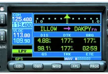
First, we checked with Garmin and their equipment actually decodes the Morse code identifier rather than rely on GPS and the tuned frequency to look it up in the boxs database. So far, so good. We next checked with Mark Kolber, our regs guru, and he pointed us to AIM 1-1-3.c. That paragraph talks about navaid identification in general, pointing out that merely hearing Morse code isnt enough because it could be transmitting TEST. Likewise, live voice transmissions from FSS or ATC dont indicate a valid navigation signal. The prize, though, is in the paragraphs last sentence, If your equipment automatically decodes the identifier, it is not necessary to listen to the audio identification. So, Rick, youre right. If the box decodes and displays the Morse code identifier, you can rely on that.
Readback: September 2019
Im so glad you tackled the question of whether it is a requirement to report leaving an altitude. I read the regs years ago and have continued to report leaving on every altitude change but I often feel I am alone or perhaps one of a small minority. Ive gone back and reviewed the regs again to see whether I was doing it incorrectly since I wasnt hearing many others doing so and it does take more air time to say, ...leaving flight level 240 descending flight level 200 than 200, when cleared from FL240 to FL200, for example.
Readback: August 2019
In the Report Leaving article in February, the approach clearance with a vector to FALIX did not include a descent. Many years ago, I was taught to stay at the last assigned altitude until established on a published route. In this case, I guesstimate that you would have only a couple of miles, at best, to lose 1300 feet after intercepting the localizer.


