Alternate Missed
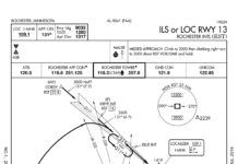
When the problem was the missed approach, my favorite tool was requesting alternate missed approach instructions. With a single ATC transmission, the requirement vanished because we werent flying that missed. At least, thats how I interpreted the regs, and the statute of limitations is past. I later realized I could even suggest my own procedure to get pointed at the IAF for the next approach. This permitted a fun game of rapid approach roulette, which is what this sim challenge is all about.
Satellite Imagery
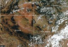
Since the mid-1970s, satellite imagery has made its way into everything from television weathercasts to flight weather briefings. We see them constantly. When a hurricane is approaching the coast, viewers are presented with satellite images. When the local news shows the forecast, a satellite image is almost always used. This technology has grown progressively more complex and powerful over the years, and more than ever it can be a valuable part of flight planning. Lets examine some of the basics of the technology and look at todays capabilities.
Clearing Flags
Its certainly legal to fly through the AIRMET. These are advisories covering large areas. But it behooves you to determine that your flight plan wont enter known or forecast light or moderate icing conditions as prohibited in 91.527. Here goes. Theres a stationary front just west of the route, bringing in cloud layers and scattered showers. Freezing levels will hit between 7000 and 12,000 feet. So, at 8000 feet, you do risk picking up ice. One lone pilot report from a single-engine turbine over Iowa shows negative ice in climb from 3000 to the tops at 11,000. This isnt all that useful since youre flying lower and slower, but you are willing to climb as high as 12,000 feet to be on top. Your Plan B, while not at all mission-friendly, is to turn back to warmer air and land in Iowa, or even return to Bowling Green if thats best.
Skew-T Revisited
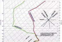
The Skew-T log-p diagram, typically just called a Skew-T, is an amazing tool for understanding whats happening in the atmosphere at a given station. They are essential for understanding a precipitation regime or differentiating icing layers. Even after nearly three decades in meteorology I would find it almost impossible to understand an icing situation without this tool, and I often visualize the makeup of an environment with a sort of mental Skew-T image. I cant underscore how valuable these diagrams are once you get to know them.
A Visual in IMC
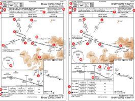
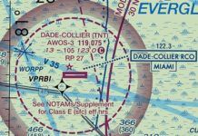
Let's consider a situation. We are flying over the Florida Everglades in low IMC. Our alternator just died, which clearly counts as an emergency in IMC. So, we must land. Now! Wind is blowing from the west at 25 knots and we are close to Dade-Collier Transition and Training Airport (KTNT). Although it used to have three approaches to Runway 9-an ILS, an NDB and an RNAV-the only one now available is the RNAV (GPS) RWY 9 approach. With that wind, we certainly will not be landing on Runway 9, even though the runway is 10,500-feet long.
Good Plan Gone Awry
Time to check Off-Route Obstruction Clearance Altitudes. These start at 3400 to 4000 feet then quickly get up to 6000. The terrain continues to rise towards 8000 feet past Scottsbluff. Uh, were not in Minnesota anymore. OROCAs, as defined by the Instrument Procedures Handbook, are for situational awareness and emergency use. While OROCAs provide standard obstacle clearance margins (1000 feet in non-mountainous areas), you cant count on them. You decide its safest to file for 8000 feet.
Deadstick: The Movie
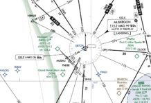
Get ready to star in this adventure by positioning your aircraft on Runway 24 at Muskegon County (KMKG) in Michigan. Pick whatever aircraft best resembles an aircraft you fly. If you have the option for retractable gear, you might want to use it as that adds a variable to this exercise and makes it more, um, fun. But the choice of the airplane is really up to you. If you fly a twin, slum it for this sim challenge and go back to the high-performance single you probably traded in for your first twin.
How the Wind Blows
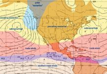
The root cause of wind is the unequal heating of the earth. We usually take it for granted that tropical areas are hot while polar areas are cold. But whether youre in Greenland or Venezuela, the sunlight is the same. Its the angle at which the suns rays hit the ground that makes the difference. Near the equator, the summer sun is at very high angles. But, in Greenland the summer sun never gets higher than about 30-40 degrees above the horizon, spreading the energy over a larger area, reducing heating of the ground and air.
Reading the Fine Print
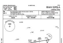
Recently, we heard from a reader with a question about an approach into Carlisle, Pennsylvania (N94). The RNAV (GPS)-A approach has a final approach course thats offset from the runway by around 12 degrees and a standard three-degree descent angle. Approaches are usually published with only circling minimums when the final approach course alignment relative to the runway exceeds 30 degrees (for most procedure types) or the descent angle is greater than 3.77 degrees (for Category C and below). Since neither of these reasons apply to this approach, why doesnt it have straight-in minimums?
Going Around Weather
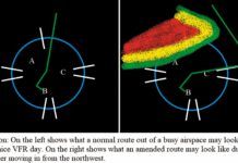
We all have a different way to go about our flight planning, but most of it is along the lines of where to go, how high, how much fuel, weight and balance, etc. You factor it all into the plan, but at some point youll add that X for some bad weather and a re-route. Maybe the weather is fine where you are departing but not good where you are going, or vice versa. Depending on the mission, what are your options? It all comes down to a go/no-go on what youre comfortable doing and not doing. This is the typical process regardless of whether youre filing VFR or IFR.
Route Planning
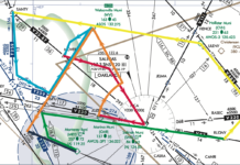
This is a long flight, so you want to minimize distance and go as direct as possible. You scan the route from TAFOY to KFSM on the chart, and it doesnt pass through any special use airspace (SUA), so you could go direct. But, you want to comply with the AIM guidance (see below) and pick a fix or two in each centers airspace. You zoom in on the chart to see TAFOY clearly, then just scroll the chart to the east along your route, looking for fixes on your route that you could add.
Making Do
There are a few things in flying life we might take for granted. In fact, some of us are downright spoiled. For instance, flatlanders (like me) get 99.9 percent radar coverage in our mountain-free region, all taken for granted. Southerners take for granted their three seasons of comfortable flying. Those who fly to larger cities all the time definitely take for granted the big runways, ATC help, and all the information they need at their fingertips.

