Weather Planning
Preflight weather planning has long consisted of calling an FAA Flight Service Station. Years ago, you might have even visited one. But, using the Internet, you can now draw on the same resources that meteorologists use. While the 2000s brought weather data to the cockpit, were now getting some Internet tools to the cockpit via dedicated datalink. Although we cant yet cheaply surf the web at cruise, we connect to the Internet at the FBO, on the ramp and in the plane on the ground, using phones and tablets with WiFi and cellular data.
Tips for Weather Planning
Remember that web sites outside the FAA and NWS domains should be considered supplementary tools to be used in combination with a weather briefing through official sources.
More Required Reports
Last months clinic began a detailed look at the reports we are required to give ATC or FSS during an IFR flight. Specifically, we began looking at the reports other than the position reports required by 14 CFR 91.183(a), which well cover separately. The remaining reports come from three sources: 14 CFR 91.183 (paragraphs b and c), 14 CFR 91.187, and AIM 5-3-3.
Briefing: November 2014
Two general-aviation aircraft designs, the Turbine Mallard and the all-metal tandem SAM LSA, are up for sale. Thierry Zibi said he enjoyed designing and building the SAM, but doesnt want to run a production company. The SAM is certified in Canada as an Advanced Ultralight, and is compliant with the LSA rule in the USA. Frakes Aviation acquired classic Grumman Mallards type certificate some years ago, and upgraded the fleet with turbine engines. The TC is back on the market now, as the current owners are ready to retire. Were looking for someone to take on the entire project, said Sam Jantzen, of Mallard Aircraft, who is working with Frakes. That would include not just the type certificate but the inventory of parts and several partially-built aircraft now owned by Frakes and based in Texas.
Readback: November 2014
Toward the end of his excellent article, Gaming the System in the August issue, Mr. Kramer talks of cancelling IFR when the frequency is busy and you have gone into VFR conditions. I have always tried to do this to relieve ATC of unnecessary responsibilities.However, this may be a little different in Bravo airspace. On a westbound flight through Washingtons Class B, I cancelled IFR after passing Baltimore and many of the buildups. The controller thanked me, replying, Maintain VFR, report any changes in course or altitude. A few minutes later I had more buildups in front of me. I reported it, and worked my way through. I have always wondered under circumstances like this if I had returned to IFR what the proper communications would have been in the Bravo air space.
Holes You Should Know About in Official WX Products
Few pilots know that FAA imposes a hard character limit on text products such as Convective SIGMETs and the Area Forecasts (FA). The Aviation Weather Center (AWC) has a check program for the Area Forecast that counts the number of characters. On busy weather days when these forecasters have a lot to mention in the forecast, they often bust the character count. This forces them to cut from either the text or the synopsis in order to make the size fit through the National Airspace Data Interchange Network (NADIN) hubs. Often the first casualty is the ellipsis (...). Forecasters can use two periods instead of three. Another casualty is the synopsis. Of course, the last resort is to cut from the text of the FA.
Tips for flying the SFRA
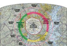
I vividly remember my first VFR flight into the Washington, D.C., Special Flight Rules Area (SFRA, previously the D.C. ADIZ). Arriving into Leesburg, Va., I ducked under the Dulles Class B airspace and entered the downwind behind another aircraft. Thats when I heard the voice: Watch your altitude. I figured Potomac Approach somehow smelled fresh blood and would have a SWAT team greeting me on landing.
Blind to the Ice
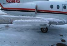
It was late afternoon and time to fly home after a productive business meeting. Before heading to the airport, the pilot called Flight Service. Most of the significant weather was along a cold front just to the north of his east-west proposed route. The briefer mentioned some light snow showers were showing up on radar near the front. There were a few pilot reports of light to moderate icing, but all of them were associated with the weather to the north. The briefer alerted the pilot to an AIRMET for IFR conditions and mountain obscuration along a portion of his proposed route, but as of yet no en route advisories for structural icing had been issued.
Flat-Screen Binoculars
Say what you like about pilots flying around with their heads up their MFDs rather than looking outside the cockpit, but when it comes to spotting traffic more than dozen wing-lengths from the airplane, a glance at traffic display is worth a hundred FAA-approved, 10-degree scans out the window.
Talk to me, baby
Ive come to believe that single-pilot IFR in a fully loaded, glass-cockpit-but without using an autopilot-can be the toughest IFR flying you can do. The past month has found me in the clouds with and without students in a couple different airframes that I hadnt recently flown. Thats important because I wasnt in the groove with known power settings and trim. Theres more load on the scan when the plane is less familiar and thats where glass shows its biggest weakness: Visual channel overload.
Readback: December 2010
I thoroughly enjoy your IFR magazine and eagerly look for it every month. I do have a concern about the front-page caption, Bitch-slapped by physics, found on the cover of the October 2010 issue. Come on, Jeff. All of you at IFR magazine are excellent writers who know how to get the information out in a comprehensible form and fashion that is entertaining and useful. Using that description for your article about V-speeds is inappropriate.
Altitude vs. Height
In his June 2014 article, Know Your Height AGL, Frank Bowlin explained the potential uses of a radar altimeter. As I read that, I reflected on my airline days where we used a pressure altimeter set to read our height above the airport. In contrast to costs of many thousands of dollars for a radar altimeter, some of the same-and critical-benefits can be had for a thousand dollars or less by purchasing and installing an altimeter dedicated to read QFE, or height above the airport. Sometimes QFE is even better.

