Garmin Still King Overall, But the Av8orace is Impressive
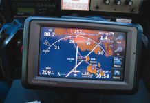
Weve put most of the current portable GPS offerings through the ringer with an eye to how they support instrument flying. Some are compact and capable, like the basic AV8OR from Honeywell or Anywhere Travel Companion (ATC) from Control Vision. Some are so big they are more like portable MFDs: Trueflights FL 210 or most of the EFBs that run on tablets fall into this group. In the end, we liked the aera and 296 through 496 Garmins the best, with a possible exception for the Honeywell AV8OR Ace.
Portable GPS in IFR
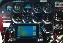
Portable GPS units are the Mighty Mice of the cockpit. They have enough navigation power and display enough data that you could fly a below-minimums approach in an emergency using nothing but that GPS and a gyro or two to stay upright. Many can supply frequencies or airport elevation faster than you can find it on a chart. And, for the majority of us pilots who fly on conventional gauges, they can take most of the guesswork out of IFR flying-even if you have a panel-mount GPS.
Theres an App for it, Even in the Air
With so many aviation apps available its simply not possible to mention them all, but here are some of the highlights. Fire up the Apple App Store to check em out.
The Iphone Cockpit
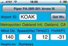
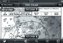
Apps for the iPhone (and iPod Touch) can do everything from get a weather briefing to viewing charts and terminal procedures (a.k.a., approach plates). While the prospect of replacing several pounds of paper charts with a small, reliable, lightweight device is certainly attractive, there are issues to consider; its just not that simple. Heres an honest rundown on just how easy (or hard) it is to use an iPhone for some common aviation tasks.
Briefing: April 2015
The FAA published its proposed rules for integrating unmanned aerial systems into the national airspace in February and drew a mixed reaction. The rules, which will apply to drones weighing up to 55 pounds used for commercial purposes, were less restrictive than many expected, but still would not allow some key technologies. For example, Amazons proposed delivery drones, which would operate autonomously or by remote control, are not allowed under the proposal-the FAA said drones can only be flown within sight of the operator. However, many uses, such as search-and-rescue, crop monitoring, and aerial photography, would be possible under the proposal, which is open for public comments until mid-April.
RNAV SIDS and STARs
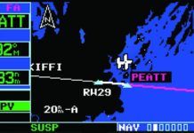
The RNAV SIDs and STARs have been around for a few years with more popping up every day. In fact, theyve become such an integral part of the ATC system that you hardly see any new SIDs or STARs that arent RNAV. Although weve published a few articles that cover certain aspects of these procedures, we still get a lot of questions about them. Its time for a thorough analysis of these procedures.
The Extra Knowledge Test: Running the Avionics
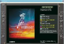
Its a pretty new idea to prep for the avionics of an aircraft before beginning training. However, the advent of the G1000 has made it near insanity for a pilot to begin a type course in a Garmin-equipped plane without a good knowledge of G1000 operations. Most of the initial failures in the Mustang course were not for inability to fly a jet, but rather for inability to master the G1000.
Old-School NDB Cool
If youre wondering if you should schedule a removal of your old ADF along with that Apollo LORAN youre yanking and tanking at the next annual, Perhaps you should consider a trip to Canada. NDB navigation is more alive up there than down here. If you dont yet have that IFR-certified GPS, you may even have a chance to dust off those NDB approach skills lurking in the back of your IFR mind.
Confusing Your GPS
When Dorothy and her gang finally met the All-Powerful Oz, he turned out to be a snake-oil salesman from Kansas working busily out of sight behind the curtain. Your IFR-certified GPS is similar in a way, with the magic a result of engineers toiling under 1000+ pages of Minimum Operation Performance specs (although they probably did come from Kansas).You should never need to look behind the curtain and check up on your GPS. But it is possible to get the box to stumble if you try hard enough.
What or Who is ARINC?
Aeronautical Radio Incorporated, ARINC, was founded in 1929. The company was owned jointly by four of the major airlines and its purpose was to provide in-flight communications between aircrews and various company facilities. It made sense to have a separate company to handle routine communications so that each company did not have to establish their own network of ground communications stations. By using the ARINC network, a flight crew at cruise between San Francisco and Portland, for example, could get a phone patch to speak with their dispatcher in Chicago.
ADS-B Out – Why Bother?
Naysayers tell us, ADS-B Out does nothing for the pilot. The faulty reasoning behind this statement is that ADS-B helps controllers, not pilots. Uh, hello? Anybody?
Flying With a TAA Mindset
Turning cockpit technology into mission capability takes more than reading manuals. Meld the surfeit of data into your decision-making process to get more from your pixels.

