Back when I was doing daily instruction in questionably fit aircraft, we ran into “required equipment” quandaries nearly every flight. We need DME to identify the step-down; we need an ADF for the missed. This was before ubiquitous IFR GPS, so meeting the requirement involved a panel of orange glowing numerals and cryptic needles … or creativity.
When the problem was the missed approach, my favorite tool was requesting alternate missed approach instructions. With a single ATC transmission, the requirement vanished because we weren’t flying that missed. At least, that’s how I interpreted the regs, and the statute of limitations is past. I later realized I could even suggest my own procedure to get pointed at the IAF for the next approach. This permitted a fun game of rapid approach roulette, which is what this sim challenge is all about.
A Monterey Round-Robin
You’ll start (and end) on the north ramp at Monterey Regional (KMRY). Set the sim for real-world weather, whatever that happens to be. The fun here isn’t so much flying to minimums as working a situation that keeps changing with each approach. Varied winds and weather makes that much more productive. Pick a fast airplane with an IFR GPS. But have a timer ready; you’ll need it.
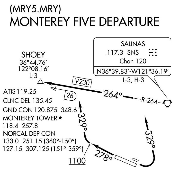
Review the departures for KMRY planning to depart Runway 28R, unless it’s a killer tailwind, in which case you may depart 10L. Either way, you’ll be assigned the Monterey Five Departure, except maintain 5000. Do what planning you need for this, deciding if you can even accept the departure, start the airplane, set your radios correctly, get the ATIS, imagine calling ground, and taxi out to the runway.
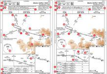
Your first approach will be at nearby Hollister Municipal (KCVH), so get its RNAV Rwy 31 ready. Switch to Tower, get the NorCal frequency ready, and launch.
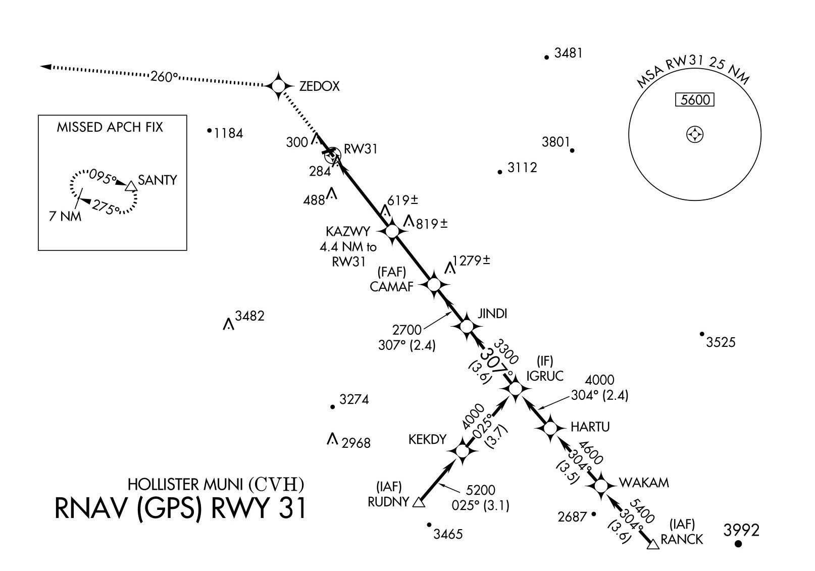
Once you’re heading 329 and passing 2000 feet, clear yourself direct RUDNY and contact NorCal on 124.52. When you check in, clear yourself to maintain 6000 until RUDNY and for the approach. Based on the winds, either fly the approach to DA mins, or circle for the best runway. Go missed at DA or on alignment with the planned landing runway. Fly the published missed toward SANTY.
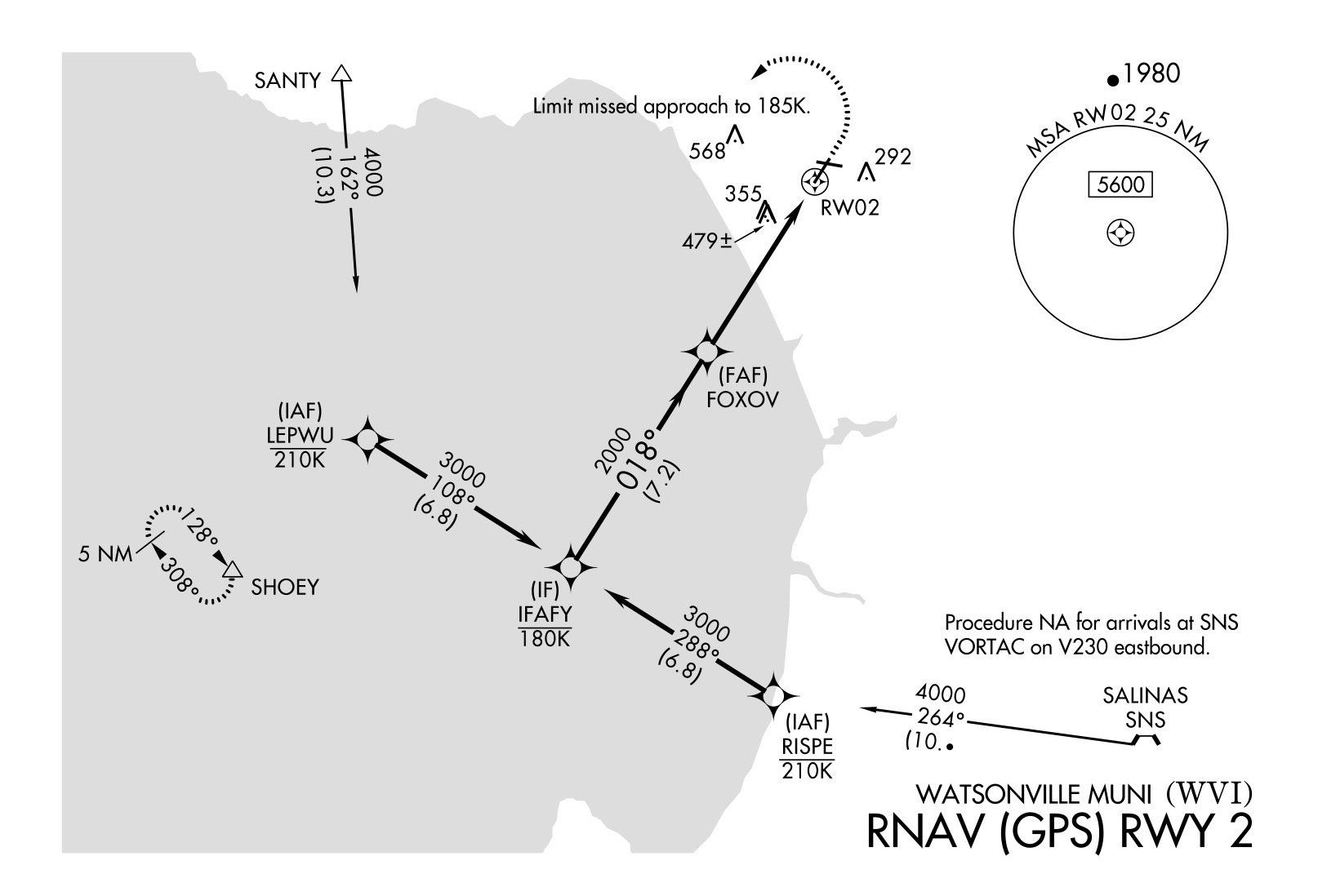
Now get to multi-tasking because while you’re flying to SANTY you’ll call up the RNAV Rwy 02 approach to Watsonville Municipal (KWVI), which has a transition from SANTY. Do your best to set up the approach to KWVI while still flying the missed from KCVH. Assume you can’t get the ASOS for KWVI just for fun. Also, contact NorCal on 127.15. Assume they give you direct RISPE or LEPWU, whichever is closest, and maintain 5000 until that fix, cleared for the approach.
Fly the approach to KWVI for a straight in regardless of wind. Try for a touch and go, and then go with the published missed toward SHOEY…
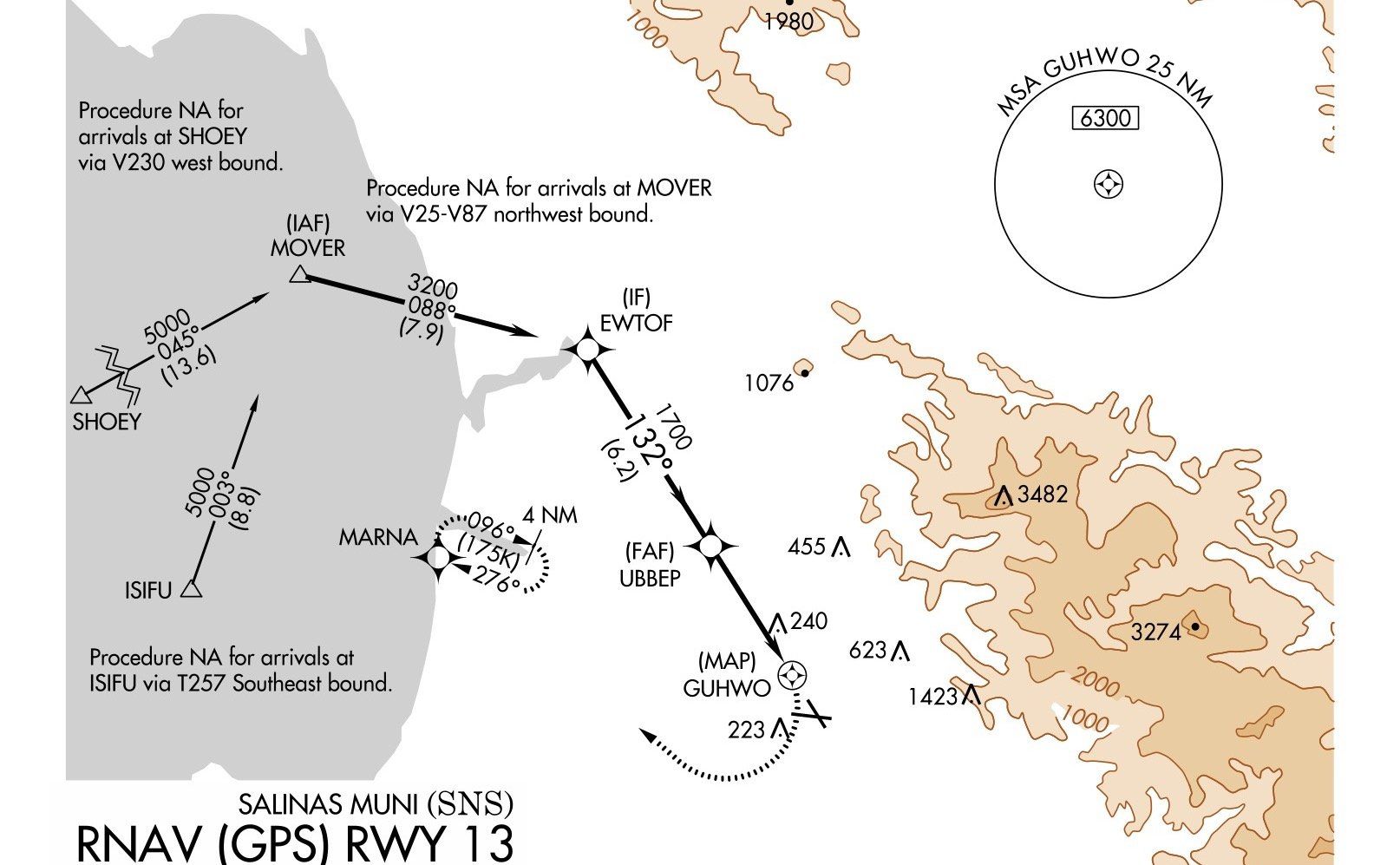
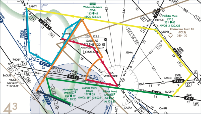
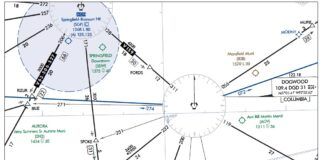
…which happens to be a transition to the RNAV Rwy 13 approach to Salinas Municipal (KSNS). Get set up in a hurry; when you switch to NorCal on 133.0, you’ll be cleared direct MOVER, to cross MOVER at or above 4000, and cleared for the approach. Before you change frequencies, though, NorCal asks how the approach will terminate. When you say you want to head to Watsonville for the VOR-A, NorCal issues you alternate missed approach instructions of a climbing right turn to 4000 and intercept the SNS R-264 to JEJZE…
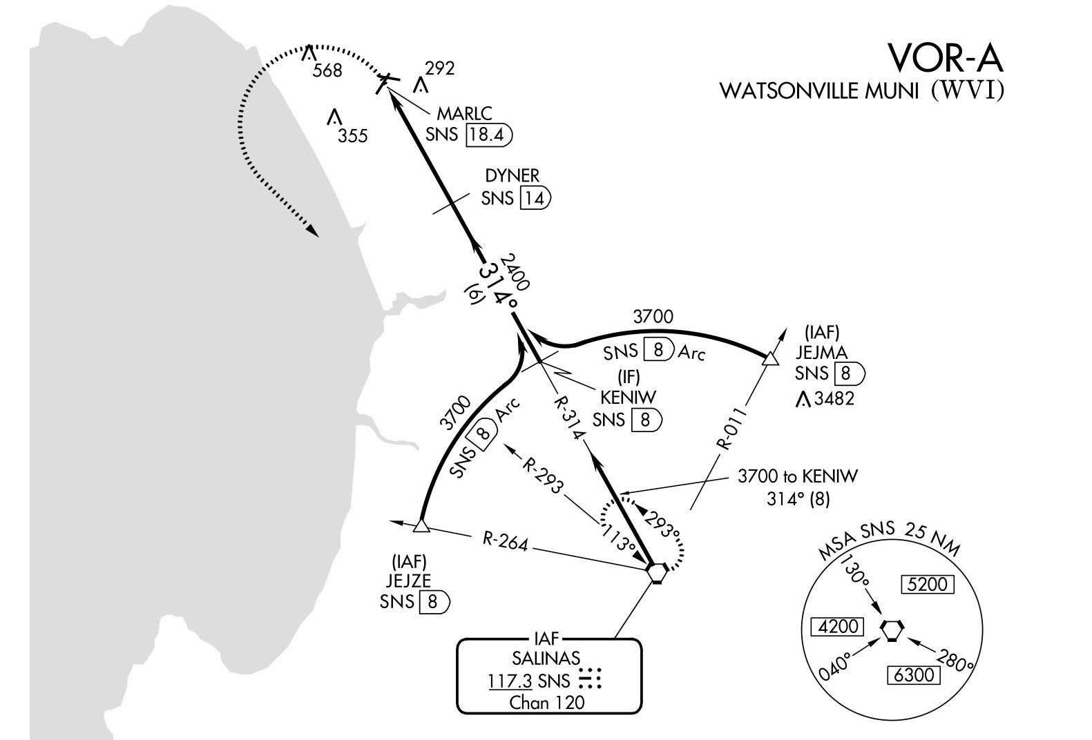
…which happens to be an IAF for the VOR-A to KWVI. So that this exercise is only one approach short of IFR recurrency, hold east at JEJZE on R-264, one minute legs.
Why one-minute legs? Because you missed the NOTAM about a GPS outage in this area starting in just a few minutes. If you have DME in your sim, turn off your IFR GPS and disable ownship on your iPad for the rest of the day. (If you don’t have a DME, you’ll need it for this approach, but nix it after that.) Hold as instructed while you brief the VOR-A. When you’re ready, fly the funky backwards DME arc to KWVI.
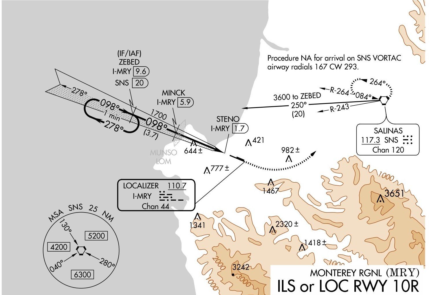
When you reach the missed approach point, follow the alternate missed approach instructions of a climbing left turn to heading 160, climb and maintain 3600, and intercept R-250 to ZEBED…
…which you’ll find on the ILS or LOC Rwy 10Rback home to KMRY. No GPS for anyone for the remainder as you fly the approach as published from ZEBED. Fly it straight in or circle as you see fit to land and make a full stop. Return to parking and call it a day. Maybe treat yourself to an adult beverage; you earned it.
Questioning Yourself
Be sure to fly this before going through these questions to see what you might have overlooked.
1. When did you turn to heading 329 departing KMRY?
2. Suppose you were departing Runway 10L in calm winds, but could only climb 250 feet per NM, and Tower told you to fly heading 075 on departure. That’s great because it gets you on course right away. Can you accept this clearance?
3. If you said “no” on #2, or the weather was low, what could you request?
4. Which NorCal frequency did you use departing KMRY?
5. What altitude did you descend to after RUDNY?
6. How did you fly the missed if you circled? How did you know you’d still meet the obstacle clearance on that missed?
7. What’s the “tr” under 260 to SANTY on the missed mean?
8. How’d you program the GPS for the RNAV Rwy 02 at KWVI?
9. What’s the line with 180K below it at IFAFY mean? To what DA did you fly on the approach?
10. How’d you like that turn at MOVER? Could ATC do that in the real world?
11. When you departed KSNS and turned to intercept R-264, how’d that go?
12. On the ILS or LOC 10R back to KMRY, R-264 and R-243 bracket your route to ZEBED on R-250. Why are those radials called out?
13. Which way did you turn for parking when you landed at KMRY?
Bonus: Why do IFR GPS units suspend sequencing at the missed approach point rather than just guiding you on the missed?
Jeff Van West lies awake at night dreaming up devious and evil Sim Challenges.


Folks, can you point me to an article that dives deeper into RNAV approaches and associated missed approaches. Specifically, this is where I am getting at. While reviewing the RNAV 17 into KJYO, the missed approach calls for a climb to a GPS fix Korny. Now if I were to lose my GPS during the approach, I would need to go missed immediately but to where? There is no alternate missed approach fix specified on the chart, or FDC NOTAMS, there is no way to identify KORNY using any other nav aid. All I have is an approximate heading and altitude before shifting over to VOR navigation. If I was unfamiliar with the airport I would climb over the airport and then establish comms with ATC. I have poured over AIM 5-4-21 and (h) basically leaves it up to the pilot to plan an “out” and fly accordingly. As a practical measure, KJYO is in a Radar environment, so if all else fails, including comms, I could always try the ILS by navigating to MRB. I can use the MSA to ensure I am high enough before trying and ATC should be able to track me using my XPDR and Radar to clear the path.
All of the above are things I could do if I was in a real fix, however, I am really curious to know what the official guidance is / recommended procedures are beyond what AIM 5-4-21 provides or I conjured up above. Thanks for all the amazing stuff you folks put out! Cheers, Krish