Next to poor visibility and low ceilings, ice is one of winter’s most common weather hazards. A recent study of icing accidents showed that 71 percent of the pilots were instrument rated, averaged 2000 hours, and over half of the flights received a proper icing forecast. This strongly suggests that ice is not well understood or is ignored.
Clearly, pilots need a review. In this article we’ll cover the topic from an aviation meteorologist’s perspective and focus only on the things you need to know. Once you understand the meteorological workings, you can couple that knowledge with your own experience and knowledge to stay safe in winter IMC conditions.
Back to the Books
Let’s first get well-grounded with a bit of chemistry, starting with water. Like all matter, water has three key phases: gas, liquid, and solid. We refer to gaseous water as water vapor, the liquid phase as just liquid water, and the solid phase as ice.
When you encounter a layer filled with the water vapor, the result is VMC. Significant amounts of water vapor may facilitate haze, particularly in the tropics, but it’s not a factor here in ice. In any case you won’t encounter any true cloud material—water vapor, by its very definition, is a gas and is transparent.
The liquid phase comes from two key sources. The first is liquid precipitation from higher layers, which appears as a rain shaft. With few large drops, a rain shaft does not degrade visibility much unless the precipitation is heavy.
The second liquid phase is a cloud. Within this cloud, the relative humidity has reached 100 percent and water vapor is forced into trillions of microscopic cloud droplets. The edges of these clouds show distinct, sharp edges, even in subfreezing temperatures. So by observing a cloud from the outside and looking at the OAT gauge, you can determine if it’s made up of a liquid or a solid—water vapor or ice.
If you fly into the solid phase, the visibility and the effects depend on the type of ice particle. Ice crystals and snow take on a cloud-like appearance, as cirriform clouds at flight levels or as snowfall streaks at lower levels. The edge of the cloud is always soft and fibrous, giving it a distinct visual appearance.
The other solid phase scenario is where the solid water is made up of frozen water: ice pellets or hail. The visibility is less restricted or even VMC since there are fewer particles, but the racket on the windshield is a giveaway.
The Mysteries of Water
Everybody knows that water freezes at zero degrees C. Even weather services commonly define the lowest zero-degrees C layer as the freezing level. But “freezing level” and “freezing temperature” are misnomers, because pure liquid water can exist as cold as -48 degrees C in a state known as supercooled water. If it’s cooled below -30 or -40 degrees the water droplet will spontaneously freeze, but this kind of process normally does not occur in most clouds.
How can this be? For a droplet of supercooled water to change to ice, it must “learn” to rearrange its molecules into a crystalline structure using a seed particle called an ice nucleus. This serves as a catalyst for the water to crystallize. Naturally, any available ice crystal is a perfect seed. Other molecules with hexagonal structures can work, too. Clay particles are one such example, making up the majority of ice nuclei in the atmosphere. Volcanic ash, fungus, pollen and even bacteria can serve as a seed.
And Then…
So what does all this mean in terms of cloud layers? Let’s start with definitions. A warm cloud is any cloud layer at a temperature above zero degrees C. It consists entirely of liquid droplets or ice particles that are melting. A cold cloud is any cloud layer that has a temperature of zero degrees C or less. It may consist of either supercooled water, ice, or both.
When the layer is entirely ice, we call it a glaciated layer. This usually happens when the cloud temperature is around -30 degrees C or colder. Few of these ice crystals or snow will stick to an airframe. The real icing problems occur in supercooled layers, normally found from 0 to -20 degrees C. There may even be a mix of supercooled water and ice, in which case it’s known as a mixed-phase layer.
Say a layer consists of extremely small supercooled droplets at about -17 degrees C. As an aircraft moves through this cloud, the tiny droplets tend to “flash freeze” onto the airframe upon impact. The result is rime icing. Because of the quick freeze process, microscopic air bubbles are trapped in the ice, giving it a cloudy, frost-like appearance.
Rime ice offers a couple of advantages. First, it rarely accumulates at a rapid rate. Also, it builds up right where you want it: on the boots and other leading edge surfaces. Very little of it sticks to the tops and bottoms of the wing, so the wing’s aerodynamic performance is not significantly degraded.
Now let’s look at the opposite scenario: a plane flies through a layer with large, warmer supercooled droplets. The temperature is -2. The droplets splatter onto the wing’s leading edge and begin freezing, but the air bubbles have a chance to work their way out. The ice looks clear and translucent, sometimes like a glaze. Not only is this clear ice relatively thick, but it grows into “horns” or ridges along the top and bottom of the leading edge.
The problems begin as the large water droplets find their way aft past the de-icing surfaces, a condition called runback. The ice coating also begins changing the contour of the wing and blocking the airflow across elevators and ailerons. In the extreme, the wing is reshaped and the air flow disrupted enough that the wing no longer generates sufficient lift.
Another View
Aviation has traditionally classified icing as rime vs. clear icing. This classification, however, is just a measure of how much air is trapped in the ice and how quickly it froze. So there is only an indirect relationship to icing severity. It actually makes more sense to look at the kind of ingredients that exist within the cloud.
The most important variable leading to icing is high liquid water content (LWC). This is a measure of the mass of water in a given volume. Where icing conditions exist, a high LWC environment means a high accretion rate—more ice, more quickly. High LWC is associated with nimbostratus (steady precipitation clouds) and cumuliform clouds, with cumulonimbus boasting the highest LWCs of all. And high LWC is normally concentrated in the lowest of the subfreezing levels, since the upper troposphere is normally quite dry.
The presence of supercooled large droplets (SLDs) is also important, though not as much as a high LWC. In spite of the name, SLDs are small and measure only 0.05 mm or larger, less than a human hair, but larger than an average cloud droplet. We find SLDs most likely to occur in deep stratiform clouds, in precipitation areas associated with rain, drizzle, and freezing precipitation, and especially in cumulus and cumulonimbus clouds.
SLDs form two ways. One is when they initially fall as raindrop or drizzle into a cold layer, and the other is through collision and coalescence—when droplets collide, the mass of droplets begins moving at increasingly diverse velocities, leading to more collisions and further droplet growth.
Droplet size is important because extremely small droplets will closely follow the path of air molecules around and over the wing, while large drops will be “thrown out” and are more likely to impact and accumulate on leading edges. In other words, SLDs mean higher accretion rates on airfoils. Large drops are more likely to fall out erratically and contribute to runback aft of the leading edge, and are more likely to produce lumpy, irregular coatings that disrupt air flow and cause control problems.
Let’s get back to temperature. From zero to -10 degrees C, water is more likely to freeze slowly and the ice will spread across surfaces. This is clear ice. But at temperatures below -10 to -20 degrees, most ice freezes quickly upon impact and statistically there is a lower correlation with a hazardous buildup.
Precipitation
We can evaluate precipitation from METAR or ATIS reports, trying to glean icing information. For example, in the case of snow (SN) or ice crystals (IC), the layer from the ground up to the cloud tops is usually comprised entirely of solid precipitation. Typically in snow, liquid layers will not exist aloft and icing is limited to light rime.
But there is one notable exception. When a supercooled layer exists beneath a snow cloud, supercooled water will contact the snowflakes and produce a heavy, rimed coating. This will be reported on the ground as graupel (GS), i.e. snow pellets, which may be mixed with snow. The existence of this type of precipitation alerts you to the layer of supercooled liquid water that may contain clear icing.
If ice pellets (PL) (sleet) is reported, liquid drops are falling into a lower cold layer. The tops of this cold layer host dangerous clear icing because it is a freezing rain layer, where liquid drops co-exist with subfreezing temperatures before they freeze into pellets. Above this layer there might be warm air without ice, but you must refer to atmospheric data or a weather briefer to be certain—the droplets might have formed only in a collision and coalescence process and there might not be a warm layer of safety.
Freezing rain (FZRA) or drizzle (FZDZ) reports indicate the same situation, except with a shallower layer of cold air. Again, clear icing is likely close to the ground, with a possible warm layer above and a separate icing layer at higher altitudes. In the case of rain (RA) or drizzle (DZ), this implies above-freezing temperatures near the ground with safe flying, but icing is possible as you climb into a cloud. Safe altitudes in rain are below the freezing level or above -20 degrees C.
Avoid Icing
Unfortunately, freezing level charts and Aviation Weather Center icing forecasts are not a silver bullet for escaping the ice. The charts will keep you safe in most situations, but when the unexpected happens, having a working understanding of the pattern along the route might save your hide.
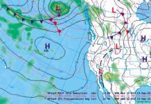
Planning for winter flying means getting the big picture. Don’t just get the TAFs. Check out the weather map. Identify whether you’re in a warm advection or cold advection situation and use that to help understand what kind of precipitation might be encountered (see the cross section illustrations).
A warm advection scenario is quite simple: warm air is replacing cold air. If you are flying across a warm front or ahead of a large low pressure area, this is what you will experience. The reverse is true in a cold advection scenario. With a cold advection scenario, lift is stronger and cumuliform clouds are more likely to occur, with small areas of deep, intense icing. A warm advection situation favors stratiform clouds, with broad areas of shallow and (usually) modest amounts of icing. However sometimes unstable warm advection regions develop embedded showers and storms, and that’s when things really get dicey.
Your Plane Matters, Too
Finally, note that your aircraft design has a lot to do with the kind of icing you get. The Cessna 208 and ATR-72, for example, have a long history of susceptibility to icing problems. Visiting forums for your aircraft types and discussing the issues with other pilots is an excellent way to help learn the characteristics and oddities of your favorite aircraft. Things like the airframe shape, the design of the tailplane, and the wing cross section all present unique accumulation and handling issues in icing. The only way you can get a clear picture of what to expect is to research your airplane.
You can pick up ice even when the outside air temperature is above freezing. One source for this is a cold-soaked wing that enters warm precipitation, which briefly coats the wing. Another source of icing occurs when the outside air temperature is just a degree or two above freezing. As air crosses an airfoil it cools as it approaches the stagnation point along the trailing edge, and depending on the wing design it may drop anywhere from 1 to 3 degrees C, cold-soaking that part of the wing and allowing a buildup of ice. So give yourself a margin of safety—flying just under (warmer than) the freezing level may still be cutting it close.
Now that you know something about icing, it’s probably a good time to review publications like 91-74A, “Pilot Guide: Flight in Icing Conditions.” If ice sneaks up on you, it will probably throw problems at you that may have been glossed over in flight school. Of particular importance is tailplane icing, as discussed in an article on page 9 of this issue.
Tim Vasquez is a professional meteorologist located in Palestine, Texas. See his website at www.weathergraphics.com.


