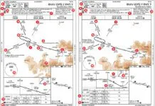
Say you’re flying to Asheville, North Carolina on a rainy IMC day. The visibility is hovering around a mile and a half and the ceiling is 1200 feet. ATC has you on vectors for the RNAV (GPS) RWY 34. Without a WAAS GPS in your Turbo Bugsmasher, you’re stuck with the LNAV minimums. The weather is above the Category B minimums that you’ll be using, so you shouldn’t have any problems. Right?

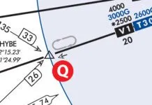
Considering only the ceiling and visibility minimums, both are above minimums, so there appears to be nothing wrong here. However, astute readers might have noticed that the reported visibility of one and a half statute miles is less than the visual descent point (VDP) distance to the runway of 3.2 nautical miles (2.78 statute miles). This means that the pilot probably won’t have the runway in sight upon reaching the VDP.
AIM 5-4-5f defines the VDP as “a defined point on the final approach course of a non-precision straight-in approach procedure from which normal descent from the MDA to the runway touchdown point may be commenced, provided visual reference required by 14 CFR Section 91.175(c)(3) is established.” (Emphasis added.) It logically follows that if descent from the MDA is commenced inside of the VDP, a normal descent to the runway might not be possible. Let’s take a closer look at the relationship between visibility and VDPs.
Normal? What’s That?
To descend below the MDA, 14 CFR Part 91.175(c)(1) requires that “the aircraft is continuously in a position from which a descent to a landing on the intended runway can be made at a normal rate of descent using normal maneuvers.” Unfortunately, for operations solely under Part 91, there isn’t any clear guidance on what constitutes a normal rate of descent and normal maneuvers. So, we’re left with our heightened common sense.
However, 14 CFR Part 91.175(c)(1) further requires that for air carrier aircraft operating under Part 135 or Part 121 “that descent rate will allow touchdown to occur within the touchdown zone of the runway of intended landing.”
The touchdown zone is defined as the first 3,000 feet of the runway beyond the threshold. If a pilot can’t manage to get the plane on the ground within that distance, I think most of us would agree that it is most definitely not a normal descent, and that the pilot has no business attempting it. With that in mind, we’ll informally define “normal descent” as one that allows you to land in that first 3000 feet.
The worst-case scenario for a Category B aircraft would be where the ceiling and visibility are at the LNAV minimums of 1000 feet and 5000 RVR. Assuming that the pilot is at MDA, sights the runway at the visibility limit, and wanted to land straight-in, in order to touch down at the far edge of the touchdown zone the effective descent angle would be about seven degrees.
At an approach groundspeed of 120 knots, that seven degree glidepath would result in a 1,488 feet per minute rate of descent. That’s certainly not “normal” by any definition most of us would be comfortable using.
This tells us when we’re flying a non-precision approach, it might not be possible to (legally) land straight-in when the visibility is close to minimums with anything but the lowest MDA.
In these situations, another option to consider if the runway is not in sight by the VDP is to fly a circling maneuver as long as the weather is above circling minimums.
Circling with the weather at minimums doesn’t sound like much fun, but it’s an option. This is certainly something to consider before going through the effort of flying the approach when the reported visibility is significantly lower than the distance from the runway to the VDP.
No Relation Implied
This problem exists because there is no direct relationship between how non-precision visibility minimums are determined and where the VDP is located.
To determine approach minimums, the MDA is first determined based on the height of the highest obstacle within the defined obstacle evaluation area. Visibility minimums are then looked up on a table which considers the height above touchdown of the MDA and the type of approach light system in use.
On straight-in non-precision approaches, the VDP is calculated as the distance required to project the applicable descent angle from the threshold crossing height (TCH) to the MDA. If the runway is served by a visual glideslope indicator (VGSI), the VDP is based on the descent angle and threshold crossing height (TCH) of the VGSI, regardless of whether it is coincident with the vertical descent angle (VDA) used by the procedure. If the runway does not have a VGSI, the VDP is based on the VDA/TCH used on the procedure.
Not all straight-in procedures have VDPs published. Most notably, a VDP will not be published when the 20:1 visual area has obstacle penetrations.
However, the lack of a published VDP doesn’t necessarily mean that there are visual area penetrations. A VDP will also not be published if the primary altimeter setting comes from a remote source, if it is inside of the MAP, or if it is outside of a stepdown fix. On non-RNAV procedures, the VDP must also be identified by a DME fix using the same DME source as other fixes in the final segment.
Additionally, sometimes VDPs that are published are not always applicable to the procedure being flown. For instance, on the RNAV (GPS) RWY 34 approach into Asheville, there is a chart note telling us that the “VDP NA with Rutherfordton altimeter setting.” In this case, if the Rutherfordton altimeter setting were used, we would need to increase all MDAs by 240 feet, resulting in a new MDA of 3360. As a practical matter, this means that the published VDP no longer applies, since it was computed using the normal MDA.
A slightly less obvious case in which the published VDP may not apply to the procedure being flown is when dual minimums are published on the same approach plate. These are found on non-RNAV procedures which permit lower minimums if a fix that uses additional equipment can be identified, such as a DME fix on a procedure that doesn’t require DME. In these cases, the VDP will be calculated using the lowest MDA and will not apply to the higher MDA.
No VDP— No Problem
The concept of the VDP has existed and has been published for many years, but pilots have not always fully understood their purpose in the execution of straight-in non-precision approaches. As a case in point, in 1989 USAir flight 105, a Boeing 737, clipped power lines while on approach to Kansas City International after descending below the MDA prior to reaching the published VDP (with an FAA inspector in the jumpseat, no less). This is why the AIM states, “The pilot should not descend below the MDA prior to reaching the VDP and acquiring the necessary visual reference.”
When visibility is restricted, it can be tempting to give into visual illusions or mistake patterns of ground lights for the runway environment, as happened in the USAir incident. This is when having a VDP is invaluable, since it allows you to know for certain the point at which you should begin your descent from MDA, regardless of what the runway looks like out the windshield.
However, as mentioned above, there isn’t always a VDP for you to rely on.
In these cases, you’ll need to improvise. Computing the actual VDP based on the descent angle and TCH requires trigonometry and isn’t exactly practical for quick use in the cockpit, so we’ll settle for a “close enough” solution instead.
Since the typical 3 degree glidepath results in a descent gradient of approximately 300 feet per nautical mile, simply dividing the applicable height above touchdown by 300 will give you a rough estimate of where the VDP should be. For instance, on the Asheville approach, a HAT of 980 / 300 = 3.26 nm, which is pretty close to what is published.
Keep in mind that an estimated VDP does not provide the same assurances as one that is actually charted. It is FAA policy to always chart a VDP when possible, so if one hasn’t been charted, there is a reason for it. That reason could be that the VDP would be located outside of a stepdown fix, so following it would result in descending prior to reaching the stepdown altitude. However, the most likely reason for the lack of a published VDP is the presence of 20:1 visual area penetrations, which could be highly problematic with an estimated VDP. Therefore, always be especially attentive to potential obstacles below the MDA when using an estimated VDP.
Missing at the VDP
The VDP is an essential component of a CANPA (Constant Angle Non-Precision Approach), which entails flying non-precision approaches in a stabilized and continuous manner similar to a precision approach, rather than the traditional dive-n-drive technique. At present, this is primarily a larger aircraft technique. Although flying GPS approaches to LNAV minimums using a WAAS navigator that provides advisory vertical guidance (LNAV+V, LP+V) is a notable exception among lighter aircraft.
That’s not to say you couldn’t give one a try. For more details, see “Constant Angle Descent” in last month’s May, IFR.
Some operators that use CANPA techniques elect to treat the VDP as the MAP. To achieve this, pilots fly a stabilized approach along the vertical descent angle between the FAF and the runway threshold, which will cause them to cross the VDP at the MDA. This is something that pilots flying light aircraft might consider while flying, for instance, an LNAV procedure even without advisory vertical guidance. However, safely using this technique requires some additional considerations.
Since a published MDA is not the same as a published decision altitude, the aircraft cannot descend below the MDA even in the process of initiating a missed approach. Therefore, pilots on a constant glidepath must initiate their missed approach at an altitude above the published MDA, such that they do not drift below the actual MDA while transitioning to a climb. Additionally, since the missed approach does not begin until the published MAP, pilots should not begin any turns depicted on the missed approach procedure prior to reaching the actual MAP, although it is acceptable to begin the initial climb. —LS
Lee Smith, ATP/CFII, is an aviation consultant and charter pilot in Northern Virginia.


